Retired_in_Texas
New member
Content deleted!
Last edited:


I'm having a hard time reconciling these two images. I suppose it's possible she had two soup kitchens. Allowing for the sun, these seem to be on opposite sides of the street.

Here's one for all you guys that have done such great research. 1301 Ocean Avenue, Santa Monica is a wonderful example of Streamline combined with Art Deco. It was built in 1939, but by whom? Remodeled in 2008 at a supposed cost of $30 million (I suspect a questionable figure). In 2010 it gained somewhat Noirish status by virtue of an incident involving a number of individuals of the Jewish faith.
[img="http://upload.wikimedia.org/wikipedia/commons/thumb/1/1f/Hotel_Shangri-La_Santa_Monica.jpg/450px-Hotel_Shangri-La_Santa_Monica.jpg"]http://upload.wikimedia.org/wikipedia/commons/thumb/1/1f/Hotel_Shangri-La_Santa_Monica.jpg/450px-Hotel_Shangri-La_Santa_Monica.jpg[/img]
http://upload.wikimedia.org/wikiped...a.jpg/450px-Hotel_Shangri-La_Santa_Monica.jpg
For 2010 story go here: http://www.jewishjournal.com/thenon...el_shangri-la_discrimination_lawsuit_20120815
Note the differences in the signage the photo in the article, as well as the removal / addition of shrubs.

Those of you familiar with Palms will know this building at the corner of Motor and National Place.

(Own work)
It surprises us at first to learn that this is one of the oldest business buildings in Palms; according to County records it goes back to 1915. The plastic signage belies its history by giving the place a decidedly bland post-WWII air.
From the side the appearance is more typical of when the building was constructed.

(From Google Earth)
And here's the strange part. Notice how what appear to be loading doors, originally intended for trucks or boxcars, are flush against the sidewalk, which seems to make them pretty much useless as such. At the same time, in the second picture there's obviously a slight rise in the level of the street and sidewalk, and as it happens if you keep going along National Place the level soon descends again. The placement of the window seems wrong as well; it's too low. Notice also how the air duct near the window has a right-angle turn near the sidewalk.
Is it possible that the level of the street was raised after the building was built? Before there was a street, is it possible that there was a rail siding between here and the Air Line?
I think you're onto something here. I went back today and got this shot:
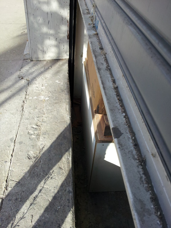
The track for the aluminum door actually goes a couple of feet below the present level of the sidewalk, so at the time of construction it was probably level with the street and intended for cars.
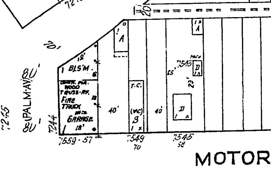


What does BLSM stand for?

If you noticed the parsonage for the Church on Manhattan Place, I wonder if it was originally just another residence - with no connection to the place of worship other than geographically. http://forum.skyscraperpage.com/showpost.php?p=6245501&postcount=16337 After all, there appears to have been a home on southern side of the Church that fronted Wilshire. I am guessing it remains an example of many homes in the neighborhood, including those that once fronted Wilshire. Come to think of it, I wonder why a building as splendidly large as that Church was not built on Wilshire?
The house to the north of Temple Emanu-el (opened 1923, congregation dissolved 1929--building sold to Christ Church) no doubt predates 1923 and is one of hundreds in the more-or-less English style built in Los Angeles from the mid 1900s to about WWI. The temple would have paid more for a lot facing Wilshire--with the money saved, they could build a better building on the side street. Also...there was already a house on the northwest corner of Wilshire and Manhattan. It was addressed 647 South Manhattan, home of Dr. Cecil R. Luton in the '20s--he died there in 1933. St. James Church at the northwest corner of Wilshire and St. Andrews was built on an empty lot--to its west was 646 South Gramercy: http://wilshireboulevardhouses.blogspot.com/2013/08/646-south-gramercy-place-please-see-our.html
The development of residential Wilshire Boulevard was actually rather spotty--there were always quite a few empty lots, many later filled with billboards.


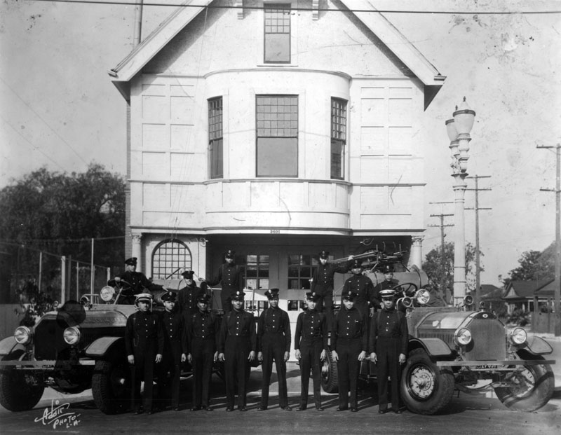
Would you believe it was once a fire station?
The January 1924 Culver City Sanborn Map shows the building at SE corner of Motor and National (Palm) with a truss roof, so it matches the structure that's there now:
LAPL
What does BLSM stand for?


Doggone it, GaylordWilshire, you stole my thunder! :worship: You are absolutely right, the address of Aimee Semple McPherson's home is 333 S. Manhattan Place.
lapl
I was So proud of myself for locating the address by looking on HistoricAerials.com. I looked for the curving walkway, the tower, and the shape of the roof next door. The latest aerial view they have is from 2005, and the house still existed then. The view below, from 1948, shows the curved walkway, while the view from 2004 shows the tower more clearly.
historicaerials.com
The neighboring house was gone before 1972.
historicaerials.com
I wish we could see what the house looked like 10 years ago. Come to think of it, though, maybe I wouldn't like to see it. Odds are it would have been pretty sad looking by then. I would love to have lived in that neighborhood way back when. Today, blech! You can have it.


 It dosen't match up with any current address on Ocean Avenue, either. So I guess we found the ADDRESS, but can anyone find the LOCATION?

All I can say is wow BifRay. These are exciting photos. Got any more?


What does BLSM stand for?
It may have been from the LaCanada Valley Sun, local paper.
It has been in my file for some time, but so far is the only photo I have; no cell phone cameras or digital cameras then, so I didn't take any at the time.
All I can say is wow BifRay. These are exciting photos. Got any more?

 :shrug:


