noirish Los Angeles


Status
Not open for further replies.
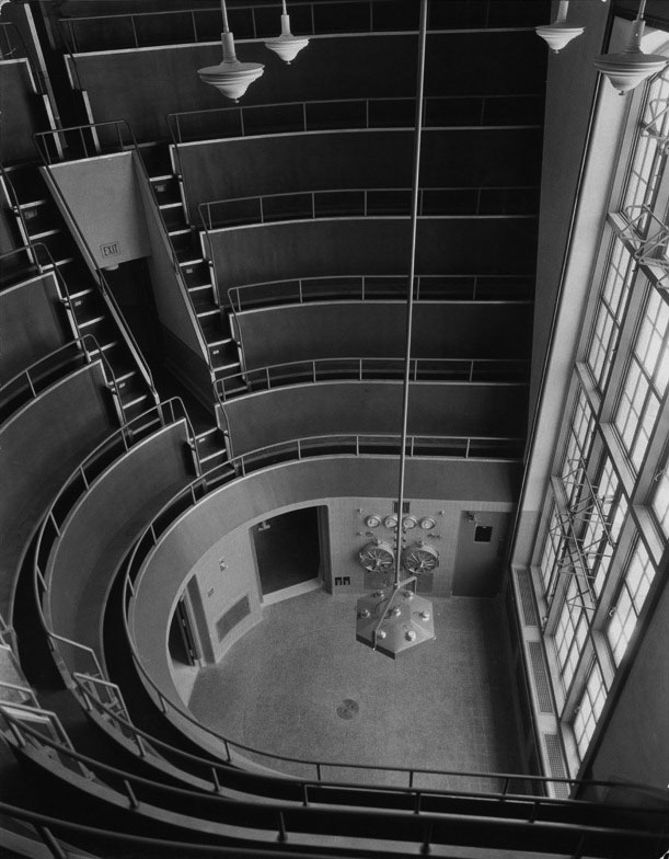
Everyone has probably seen this photo of an interesting operating theater with stadium seating at the old County Hospital,
taken when it was newly opened...
General_Hospital_1933.jpg

(DWP Photo Collection at WaterAndPower.org)

Well, I got to wondering where in that giant 18 story building that room could possibly be. I figured the main clue is that huge 3-story, four section high window. Flipping through some pics, I noticed that there was only one such fenestration, at the 15-17 floor, west end of the building (highlighted yellow):
LAC%252BUSC+detail.PNG


Had some time at lunch today, so I went up and looked. Sure enough, there it was:
20130722_115418.jpg

Fun discovery jbange. I've often wondered what was behind those 3 story windows. It never dawned on me that it would be the operating
theater.
__
 
Last edited:
...I felt I'd lost my momentum here and that it would take months to catch up.

Right there with you. An overabundance of work plus some tragic real world events have left me feeling like I'm running along the tracks trying to get up enough speed to hop back in the norish boxcar. Not there yet, but not gone either, just reverted to lurker status.
 
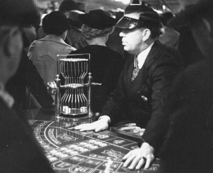
for Chuckaluck a Chuck A Luck
kf9w.jpg

made in Los Angeles/ebay

__


:cheers:

You need to live a little. Next time you visit the Clover Club, take your chips to a new table!

Just make sure you leave at the appropriate time. (Before it's too late.;))

Confiscated equipment.
00039658.jpg
http://jpg1.lapl.org/pics40/00039658.jpg


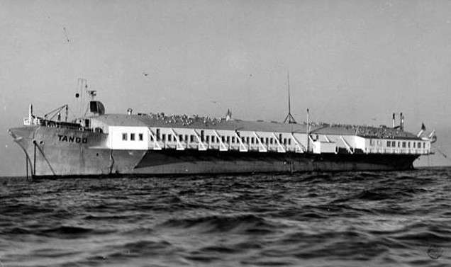
And if you choose to play the slots on the Rex, this might explain any salty payouts.:shrug:
00046129.jpg
http://jpg2.lapl.org/pics23/00046129.jpg


Wherever you go, keep an eye out. There have been a lot of unconfirmed reports. . .

"On Wednesday, Herald Examiner artist Chuch Huges drew this picture of Buena Foot from eyewitness accounts".

00083559.jpg
http://jpg1.lapl.org/00083/00083559.jpg


1982 Monster hunt
00083560.jpg
http://jpg1.lapl.org/00083/00083560.jpg
 
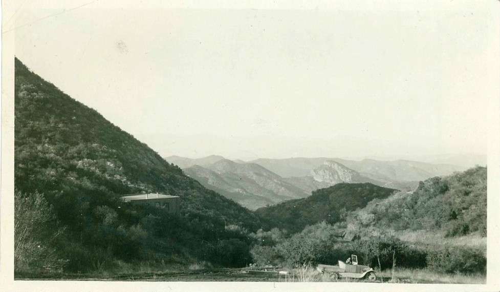
mystery rock formation, 1920s
k15t.jpg

ebay

o777.jpg

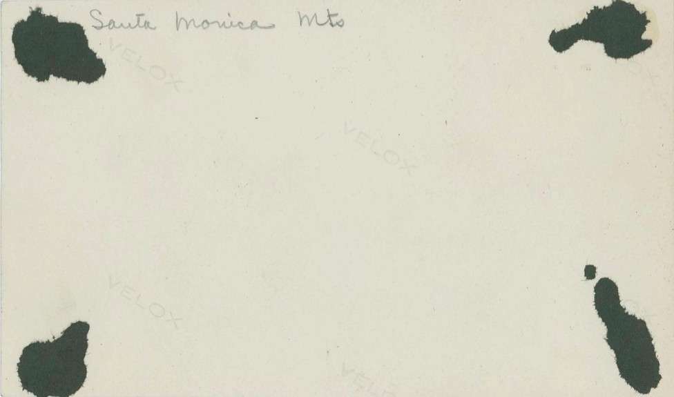
reverse

I'm interested in that impressive rock formation in the distance. Does anyone know where this is located in the Santa Monica mountains?
...or is this snapshot mislabeled?
__
 
Last edited:
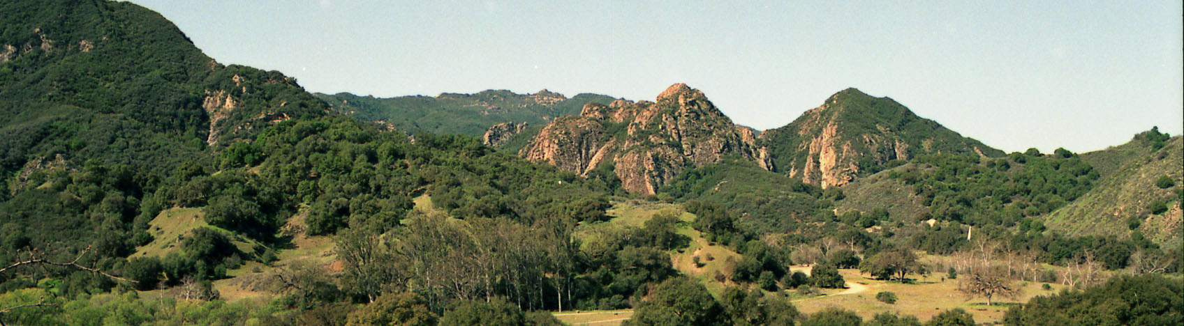
Try ... 20th Century Fox Ranch Area * Malibu Canyon
used in early Silent films (Buster Keaton & Fatty Arbuckle)

images

-
And also M*A*S*H set location area is the same place
-
websiite_masthead_9-7_HR.jpg

-
mystery rock formation
k15t.jpg

ebay

o777.jpg

reverse

I'm interested in that impressive rock formation in the distance. Does anyone know where this is located in the Santa Monica mountains?
...or is this snapshot mislabeled?
__
 
:previous: rentatrip, you're probably in the right area but I don't see that particular formation.
-am I looking at it from a wrong angle?

__
 
Last edited:
Oh God yes! you hit the nail on the head. I love LA and all, but driving to or from LAX is my hands-down least thing to do here, well, going to the dentist is my first. I despise going there. I had to do it two Fridays ago to pick up my other half's sis who was visiting LA for business during the weekend. At 12.00 Midday, they had half the lanes before terminal 3 closed for construction (filling potholes with hot asphalt) on the road. Traffic was a nightmare, and even traffic on a nice day still is a nightmare. Great going there planners! it's so cool that you didn't do this at 3.00 AM but had to do it in the middle of the day.

http://laist.com/2009/10/23/lax_ranked_3rd_worst_airport_in_the.php

It sure makes me miss the old LAX (well, airports in general used to be much more interesting and accommodating not only for travelers, but also especially for their friends and family, who are now banished to the limbo of the dingy baggage claim/arrivals area). I understand why they needed to add the pier concourses between the satellites and the ticketing area, but in the process they utterly squashed its personality.

Regarding your experience picking up your SIL, I think we should consider banning private party pickups and dropoffs. There are shuttles, buses, taxis, and one day maybe even a train. Every shuttle or taxi that carries departing passengers to the airport can take arriving passengers away; private party pickups/dropoffs double the traffic per event. And let's face it--if you're the friend or relative, it stopped being any fun when they barred you from the terminal.
 
Wulff's Peak FOUND!

I too am glad that 3940dxer is back!

e_r's post :
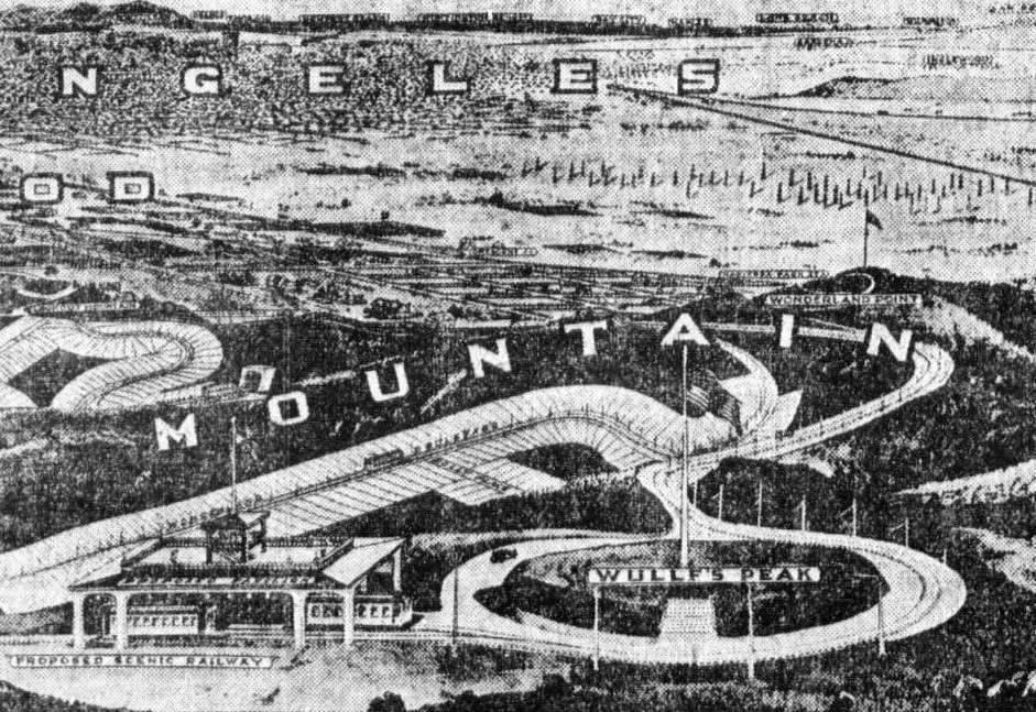
vwqc.jpg

Los Angeles Daily Herald

This image, from a 1909 newspaper ad for the new Lookout Mountain Park subdivision is an artist's rendition of what a bird might see looking SE over the development. We see Lookout Mountain at the left, Wonderland Point at the right center, and in the lower foreground, Wullf's [sic] Peak.

Locating these peaks is not easy, as contemporary maps of the area are sparse at best. Even though Lookout Mountain Park was subdivided in 1908, it didn't become part of the City of Los Angeles until the Laurel Canyon Annexation in 1923.

Here is the big announcement in the LA Times of August 14, 1908, describing the tract and its main features:

d5ce.jpg


The length of the ridge is exaggerated, and the altitudes of the three principal features are incorrect. And the Scenic Railroad never happened, nor were the roads "already built."

Five years go by, and the LA Times has another article on the development:
bf4h.jpg


Here, it is explicitly stated infamous oil baron E.L. Doheny is buying Wulff's Peak to be able to survey all his Beverly Hills properties. The seller is the Lookout Mountain Park Land and Water Company, the original developer.

Given that I knew the transaction date, and the names of the principals, I thought I might be able to find the 1913 deed which would contain a legal description of the land being soid. Then I might be able to overlay the boundaries onto a contemporary topo map to see if the Times article was correct in placing Wulff's Peak in Doheny's new purchase.

So I went to the County Assessor's Office in Norwalk and after some difficulty obtained a copy of the August 1913 deed from LMP to Doheny, which gave enough information to determine where the land was.

Here is the deed:
25n1.jpg


Not being a surveyor, I ended up googling mapping software. I found one called "Metes and Bounds" that wasn't too expensive and didn't look like it had too steep a learning curve. Using it, I was able to turn the surveyors' jargon into a map plot and superimpose it onto a contemporary topographic map with the following results:
g2ns.jpg


The boundary of Doheny's acquisition is marked by a thin black line. "Metes and Bounds" concluded the property was indeed 22.11 acres in size. The property contains a high point (el. 1554') which could only have been Wulff's Peak, just like the Times article said it did.

Below is the current topo map of Section 6. Wulff's Peak is just southeast of the large water tank "WT" shown in the lower left quadrant.
aflu.jpg


To give you an idea of what the plat map for Lookout Mountain Park looks like, here is:
oqe7.jpg

Even though the reproduction is terrible, the land sold to Doheny was part of lot D and is at the lower left-hand part of the map. You can see the shapes of lots adjoining Wonderland Avenue and Lookout Mountain Avenue.

Today, the top of Wulff's Peak looks like this:
53n0.jpg

Not exactly glamorous for the "Belvedere of America."

Next I'd like to establish where Wonderland Point and Lookout Mountain were - here's looking at ya, 3940dxer, for help ;)
 
Last edited:
Parched?

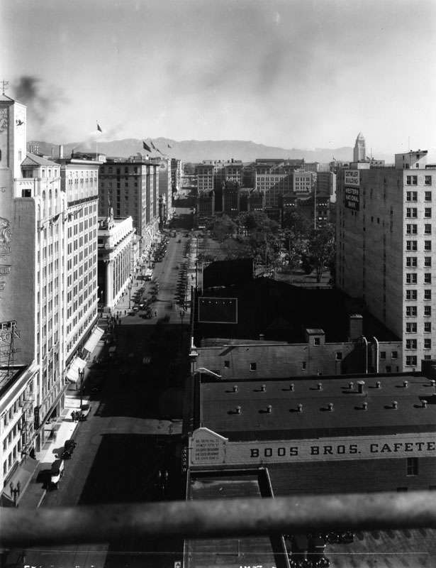
I wonder whether the Boos Brothers of Cafeteria fame (mentioned several times on the thread) ever met the Roos Brothers (Hollywood Blvd. Clothiers). Both sets of siblings no doubt encountered some of the Warner Brothers' product, and in the end, the Pierce Brothers. Somehow, at sometime some any or all of these brothers could have had a sip or two of Imperial Beer, provided by the brothers Grace.

PRSH7BUBN2NVY7KEHC5X1SRL18XPIA.jpg
http://catalog.library.ca.gov/exlibris/aleph/a19_1/apache_media/PRSH7BUBN2NVY7KEHC5X1SRL18XPIA.jpg

cliftonearlierwasboosbr.jpg
http://img209.imageshack.us/img209/4545/cliftonearlierwasboosbr.jpg


00008594.jpg
http://jpg1.lapl.org/pics18/00008594.jpg http://forum.skyscraperpage.com/showthread.php?t=170279&page=302

CEM46583066_111441322148.jpg


Grace Brothers Brewing History: http://gracebrothersbrewery.com/brewery-1933-1946/


Grace Brothers Brewing
$T2eC16V,!y8E9s2fjtksBR8SzBI4Sw~~60_3.JPG
http://i.ebayimg.com/t/Unused-1940s-Imperial-Beer-label-Tavern-Trove-Grace-Bros-Los-Angeles-California-/00/s/MzYxWDUxMQ==/z/CuEAAOxyyrRR8SzB/$T2eC16V,!y8E9s2fjtksBR8SzBI4Sw~~60_3.JPG


Grace Bros survived as long as it did survived because it brewed private labels for Safeway, Purity, Lucky and other supermarkets, and for some of the larger liquor stores. All the beer was the same except Bull Dog Ale and Stout and GB Bock beer. (A bock beer is hoppier and caramelized malt is added for color.) The various cans were different in appearance, which caused much confusion and not a little humor around town. Still, some local folks had their favorite beers and believed Grace Bros. brewed many different ones http://gracebrothersbrewery.com/grace-family-conclusion/


Grace Bros presence at LA County Fair - 1937
00082005.jpg
http://jpg1.lapl.org/00082/00082005.jpg


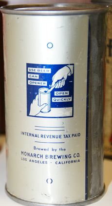
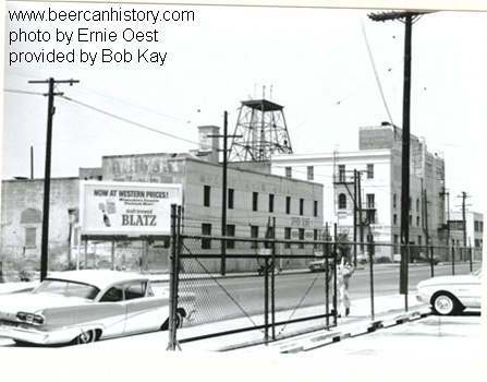
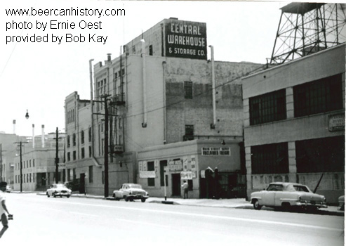
Where was Grace's LA Brewery? According to one source, Grace Bros. was home based in Santa Rosa, but had acquired many other breweries. In '41 Grace Bros. bought out Monarch, which was at 619 Antonia Avenue. ('42 directory listings for breweries http://rescarta.lapl.org:8080/ResCarta-Web/jsp/RcWebImageViewer.jsp?doc_id=Los+Angeles+City+Directories%2FLPU00000%2FLL000004%2F00000001&view_width=20&rotation=0&query1=&query1_field=0&collection_filter=false&search_doc=2697&submit=Find ) Some sources indicate Monarch was a few blocks from Eastside Brewery - in East LA. Does "Antonia" Avenue still exist? There is a residential street named Donna Antonia Ave, zip 91744, but that seems far afield.

monarch_label.jpg
http://beercanhistory.com/pics/monarch_label.jpg
URL]


monarch_brewery1.jpg
monarch_brewery2.jpg
http://beercanhistory.com/pics/monarch_brewery2.jpg
 
The noirish spirit blows in Paris

This morning, in the Parisian subway, I saw the poster of "R.I.P.D.", an Universal motion picture by Robert Schwentke, starring Jeff Bridges and Ryan Reynolds. On the poster, the perpetual fuckery of violent blockbusters : pointing huge guns, speeding and exploding cars, exploding fires etc. BUT, instead of the usual modern buildings in the background, beautiful buildings of the 1910's ! Not even 1920's to 1940's ! I couldn't believe this amazing change ! I guess, somebody at Universal follows The thread to catch production ideas.
 
Last edited:
Not being a surveyor, I googled mapping software and found one called "Metes and Bounds" which I used to turn the surveyors' jargon into a map plot and then superimposed the property map onto the contemporary topographic map with the following results:
g2ns.jpg


Doheny's addition is marked by a thin black line. It is indeed 22.11 acres in size, and includes Wulff's Peak.

Admirable research Lorendoc. Good job!
__
 
Status
Not open for further replies.


Back
Top