noirish Los Angeles v2.0


.
Currently on eBay


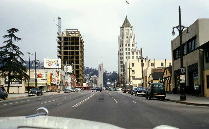
"VINE ST HOLLYWOOD BROADWAY PLAZA HOTEL c1953 35mm Slide Red Border Kodachrome"


eBay

Is the eBay seller correct or are we looking north on Ivar Street?...

Something seems off.


.
 
.

Has anyone heard of the 'Pacific Film Studio?..


Recently found on eBay.

. .or for that matter, Vernon Dent or Violet Joy?

.

Vernon Dent, yes, from Three Stooges shorts. Pacific Film, no, but here's what I found:

Pacific Film's offices were at 730 S. Olive in LA:

509633eb-8086-4918-8566-143fbb5e99a3.jpg


1921 Motion Picture Studio Directory and Trade Annual @ HathiTrust


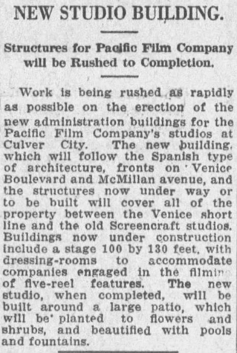
The Pacific Film studio was at the NE corner of Venice and Durango (ex-McMillian):

fdbb52b5-a35b-406a-832a-48ce2ca3e5f6.jpg


Feb 27, 1921, Los Angeles Times @ Newspapers.com


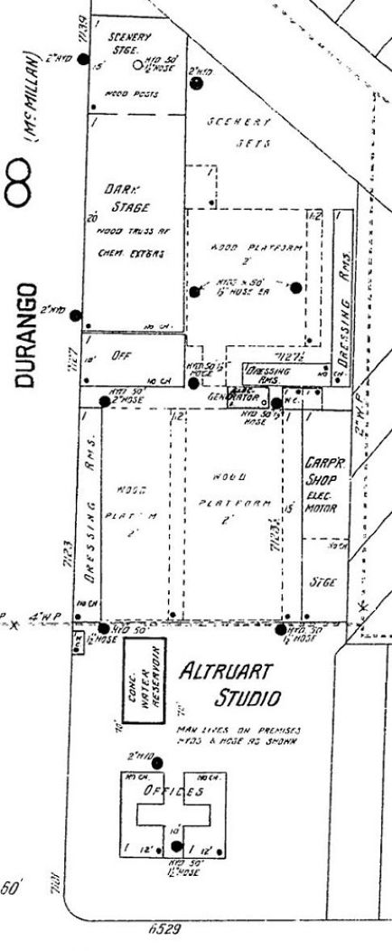
Here's the location on the Jan 1924 Culver City Sanborn Map, by which time the studio name had changed:

4d3c3864-a8f9-4eab-90f5-9de804acc09b.jpg


ProQuest via LAPL


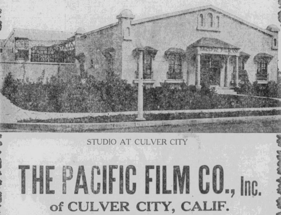
This is the only photo of the studio I came across:

9d1428d5-9772-417f-9a2c-456cb50d1de8.jpg


Sep 28, 1922, San Pedro Daily Pilot @ Newspapers.com


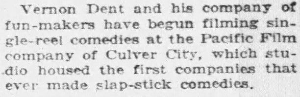
I haven't forgotten about Vernon:

97a385c7-55fa-4a90-9840-7b72a9d46b7b.jpg


Mar 8, 1921, Los Angeles Record @ Newspapers.com
 
.
Currently on eBay


"VINE ST HOLLYWOOD BROADWAY PLAZA HOTEL c1953 35mm Slide Red Border Kodachrome"


eBay

Is the eBay seller correct or are we looking north on Ivar Street?...

Something seems off.


.

I’ve never heard any explanation of it but remember that the section of Ivar below Hollywood Blvd. was an extension built after other roads existed. Below Selma there was an existing street to the east before Vine. And Cosmo to the west did not reach down to Sunset. So it seems they just bent Ivar over in that direction to match the Cosmo alignment and have a logical spacing between block intersections along Sunset.Thus the odd view below Selma where the twist occurs. (What was originally up by that parking lot behind The Plaza was the Los Angeles-Pacific freight yard and stations and a lumber yard below it. It wasn’t planned as a street until years later when the center of the Hollywood district shifted away from Cahuenga toward Vine.)
 
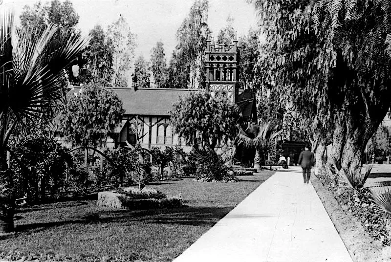
And here’s another on Martin’s blog of St. Stephen’s on Prospect (Hollywood Blvd.) that looks west along the sidewalk: https://martinturnbull.com/photo-bl...prospect-ave-hollywood-circa-early-1900s-1-2/

The thing to notice here is a trolley car beyond the church which is entering Prospect from the rail yard that sat where the Ivar Avenue extension would eventually be built down to Sunset (see E.R.’s recent post on that street). You may have to stare at it to see, and the trolley pole extends up on the right. As far as I know, this is the only photograph that ever captured a passenger trolley in the offstreet parking area. They originally stopped in the middle of the road so everyone could walk over to the DeLongpre studio, but that practice was brought to an end, maybe due to congestion problems.


IMG-6245.webp


sourced Martin Turnbull as above.


A 1940s slide from the Hemmings automotive site....I think that's the Hollywood Hills in the background, so my guess is we are looking north from what is now Koreatown.

From Vintage Los Angeles on Facebook:

It's The Evanston Apts. on Kenmore just north of Wilshire (657 S. Kenmore Ave ). Solved by VLA fans, Said Al-Alaoui and Rick Goff!​

The 1928 Evanston Apartments are actually at 630 S Kenmore Avenue, but yes, it's Koreatown. Roughly the same spot on GSV.
 
Today, according to: https://www.homes.com/local-guide/malibu-ca/encinal-bluffs-neighborhood/

Encinal Bluffs

Neighborhood in Malibu, California
Los Angeles County 90265
$6,160,698 Average Value
$3,333 Average Price per Sq Ft
23 Homes For Sale
An exclusive Malibu coastal community

In Western Malibu, right along the Pacific Coast Highway at Encinal Canyon Road, the cliffside enclave of Encinal Bluffs is a long line of gated, multi-million-dollar mansions that overlook the Pacific Ocean.
_________________________________________________________________________________________________________________________________________


Thanks for the information on Encinal Bluffs and the word encinal, Engineeral and odinthor...I appreciate it. :)


.
 
. . . mystery location II for Fri., June 19th.

"Orig 1950s Los Angeles Purser Hotel/Apartments California LA CA 2.5" Photo Negative"


Link

:whip:
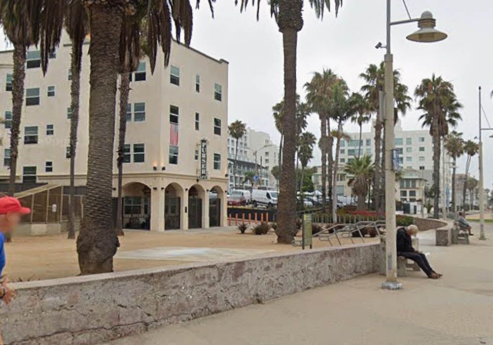
The Purser Apartments (or nowadays just The Purser) are still standing at 1659 Ocean Front Walk in Santa Monica. Built in 1930, I think that's the same sign that appears in the photo above.

cf023a22-9e59-493a-9017-a71adc52a328.jpg

GSV
 
Here’s one from Martin Turnbull’s photo blog…does anyone know more about the Malt Shop that stood on the corner of Hawthorn & Highland: https://martinturnbull.com/photo-bl...blvd-and-beyond-hollywood-circa-late-1950s-2/

The shot looking north on Highland:

IMG-6243.webp


sourced Martin Turnbull as above linked.

I believe this became a sporting goods store, possibly a relocation.


To add some identity clue, I’m told by a Hollywood High schooler of the mid ‘60’s (if you can remember it you weren’t there) that it was known at the time as The Teddy Bear.


Back
Top