• City-versus-city activity is flat-out banned from being posted here in all its forms.

    City vs city trolling sets up a rather nasty and personal fight between forumers from one place and forumers from another place, potentially affecting hundreds of members any time it breaks out. Nothing good comes of versus-trolling, but long after the insults and mockery have been removed, bad feelings between individuals and between groups tend to linger, oftentimes popping up in unrelated threads for months afterwards.

    Thus, when it comes to 'versus' trolling, a line must be drawn--sharply. Anyone who crosses that line shall be disciplined, up to and including suspension and even summary banishment without warning. Forum moderation and administration shall be the arbiter of what constitutes versus-trolling, so if you think your post might be perceived as an unfair attack on an entire city that will upset residents there, tread lightly or reconsider how you intend to express your opinion. No forumer shall successfully claim ignorance of our policy against versus trolling, and no forumer should believe he can get away with it.

    The ban on versus activity applies to all posts and all threads, even ones that are not initially set up as city-versus-city.

    If you see any troublesome posts please report them using the "report a post" icon -
    report.gif
    in the upper right corner of every post on the forum.

Canadian cities are about as dense as German cities


So several reasons.

1.Historically nothing could be taller than Buckingham Palace (though they often ignored the ruling),

Interesting. Was that rule for all of the England, or just for London?


4. Depopulation. WWII marked the turning point, as London started declining. Bombed out, losing its empire and industry, while many surged beyond the green belt to live in the suburban
Southeast. By the 1980s the city had reached a nadir of 6.4 million and 1/8 of the land lay derelict.

Wow, I did not realize London's population decline was so severe. London's decline between 1951 and 1981 was very well in line with the big industrial cities in the U.S. over the same time period:

London
1951: 8,164,416
1981: 6,608,513 (-19%)

New York
1950: 7,891,957
1980: 7,071,639 (-10%)

Chicago
1950: 3,620,962
1980: 3,005,072 (-17%)

Detroit
1950: 1,849,568
1980: 1,203,368 (-35%)

Boston
1950: 801,444
1980: 562,994 (-30%)

Philadelphia
1950: 2,071,605
1980: 1,688,210 ( -19%)
 
Glasgow and Liverpool the most extreme example in Britain:

Glasgow
1951: 1,089,555
1981: 774,068 (-29%)
2001: 575,180 (-47%)
2022: 617,794

Liverpool
1937: 867,000
1981: 607,454 (-30%)
2001: 439,473 (-49%)
2022: 486,088

In Germany too: their big industrial cities in the West grew like crazy on the post-war miracle, also fueled by Germans moving from the East, but after the 1973 shock, they experienced a decline as well:

Essen
1963: 730,970
1980: 647,643 (-11%)
2011: 566,201 (-22%)
2022: 571,039

Hamburg
1961: 1,840,543
1985: 1,579,884 (-14%)
2022: 1,808,846

Berlin
1939: 4,330,640
1980: 3,048,759 (-30%)
2011: 3,292,365 (-24%)
2022: 3,596,999

In Britain the exodus mirrored the US one as it was the first developed country to experience desindustrialization. In continental Europe, the early 1970's was the peak and the oil crisis was the most transformative event.
 
What was Berlin's population right after the end of the war, prior to partition?

According to AI sources and Wikipedia:
n August 1945, Berlin's population was approximately 2,807,405. In 1939, Berlin's population was 4,338,756

800px-Berlin_Population_1920-2024.svg.png


800px-Population_pyramid_of_Berlin_in_1946.svg.png
 
Last edited by a moderator:
I find very hard to tell how many people were in Berlin right after their fall. The city was in ruins.

The British bombing of Hamburg in Aug 1943 killed 40,000 people, 180,000 were injured, 220,000 houses were destroyed and almost 1 million people fled the city (out of 1.7 million in 1940) in the aftermath of the bombing. That gives an idea of how many people might leave in such extreme conditions.

Not getting into internationl politics, but sadly we've seen the same thing in Gaza now. It's been completely razed, in WWII style, but somehow a good chunk of the population is trapped there. The same might have happened on the German cities. The majority of people don't really have another place to go.
 
Maybe more "empty nesters" in German cities. Same thing happening in Canada recently, but I am sure it is more prevalent in Germany. It might also explain some of the population decline in London since 1951.

Be careful comparing population density of individual suburbs which probably have more residents and fewer jobs (less "live/work"). A suburb might even have higher population density than a city core, but only because there are no jobs. German suburbs probably have more jobs than Canadian suburbs.

But I think it is fair to say here is not a strong drop-off in density outside of the core in both Canadian and German cities. Why use weighted density just to exclude dense suburbs?

I don't believe in "weighted" density to exclude or diminish the low density (because what is the point of talking about density if we ignore the low density?), but it is important to account for the extra green space in NY compared to LA that has been mentioned multiple times.
 
For London the decline started with the evacuation of millions of children in the outbreak of WWII, many never to return. The Blitz that followed was on a similar scale to the razing of Berlin (1.3 million made homeless, the same figure in both cities) -just London was so large it absorbed the bombing and took 3 months straight of mass raids each night, with only 1 day's reprieve.

The war marked the steep decline for the Empire, coupled with de-industrialisation. Millions eventually left for leafier climes -leapfrogging the Green Belt or moving into it, that created the vast hinterland of Southeast/ East England.

Things turned around in the late 80s, with the economic boom. 'Cool Britannia' and migration, which absolutely saved the city, but it took until 2015 to recover the former 8.6m mark for city proper (it's now 9.4m).
 
Last edited:
Interesting. Was that rule for all of the England, or just for London?

It was for London mainly (though they ignored it after Queen Victoria's death at the turn of the century).

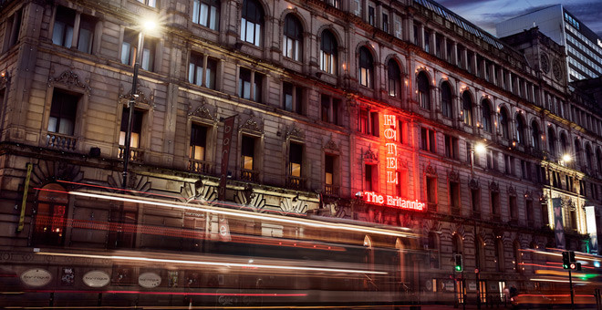
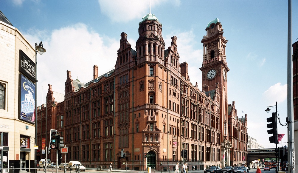
Other cities didn't really have a need as they were much smaller, but parts of Manchester -even Liverpool - have their moments when you feel in a bigger city, due to the extra floor or three, plus more of a grid plan with straight avenues:

stjamesbuilding1.jpg
704-overview-slide1.jpg


stock-photo-aerial-view-of-manchester-town-hall-city-centre-1065508028.jpg


PalaceHotel.jpg


1-the-three-graces-pier.jpg


Birmingham too, but it was bombed and bulldozed flat

2_Corporation-Street-c-1900.jpg


army-navy-stores-victoria-london-14266071.jpg.webp


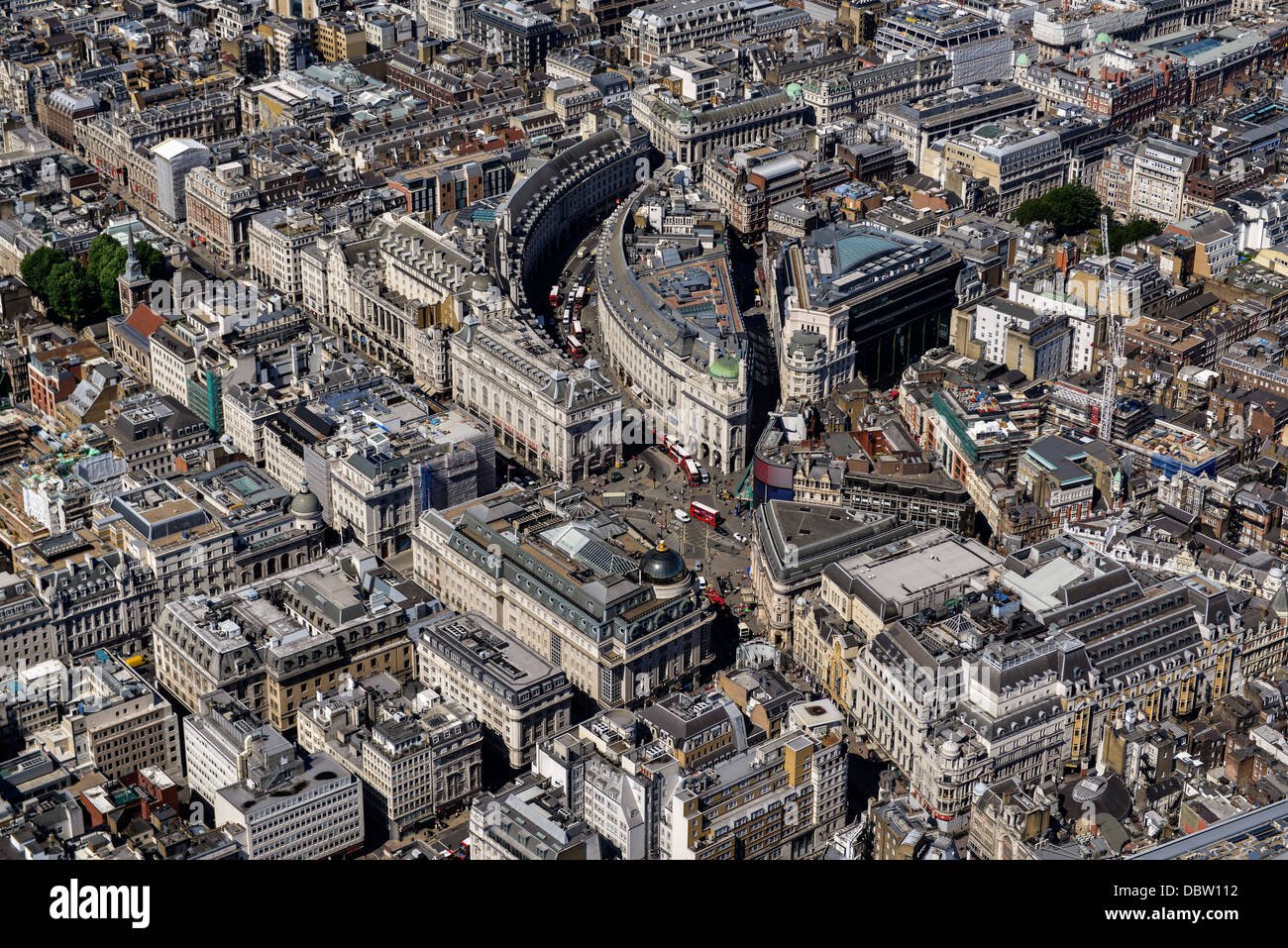
...Although as reminder, London does still have endless, dense streetwalls of massive buildings, taller than Paris - just the floors are so large.
On narrow, winding streetplans, you can't really judge height either.

aerial-view-of-the-strand-and-aldwych-central-london-uk-looking-west-E8E1BB.jpg


aerial-photograph-of-regent-street-and-surrounding-area-DBW112.jpg


For scale, the first floor of the cathedral is about 80ft

w1000-901727Nfikr7vV.jpg
 
Last edited:
I find very hard to tell how many people were in Berlin right after their fall. The city was in ruins.

Berlin, at least for a short while, likely had a tiny fraction of prewar population. The city largely evacuated before the advancing Russian army, and many never returned.
 
Guys, a silly question: Canadian cities have very rigid growth boundaries, with urban development ending abruptly. Not sure if the term smart growth is still in use to describe those policies.

Who gets to decide whether a given piece of land will be next to be urbanized? Patterns are also a bit weird: for instance, Toronto’s northern urbanized panhandle. Or will Milton will be allowed to be linked to Toronto with continuous urban development?
 
Who gets to decide whether a given piece of land will be next to be urbanized?

Ultimately, the Province of Ontario.

Under the Canadian Constitution, municipalities are 'Creatures of the Province'.

Meaning they exist as the pleasure/discretion of the province and under such rules as the province sees fit.

***

The Greenbelt as a formal no go zone for development, for the most part, is a provincial creation.

But there are also 'Urban Growth Boundaries' these, nominally, are generally set by the Cities/Regions in question.

However, I say nominally, because they must submit any changes to the provincial government, which may then approve,send back, or alter, any proposal.
 
Guys, a silly question: Canadian cities have very rigid growth boundaries, with urban development ending abruptly. Not sure if the term smart growth is still in use to describe those policies.

Who gets to decide whether a given piece of land will be next to be urbanized? Patterns are also a bit weird: for instance, Toronto’s northern urbanized panhandle. Or will Milton will be allowed to be linked to Toronto with continuous urban development?
Long-range planning. I guess it depends on the metro area as to who does the long range planning.

I recently encountered this plan for the city of Saskatoon in which they've already got planned out where development will go for when they have 1 million people:

https://www.saskatoon.ca/sites/defa...g/wall-maps/projected_growth_concept_plan.pdf
^little blue map at top-right.

For reference, Saskatoon currently has about 300K people.
 
Last edited:
As provinces handle, I guess it’s much easier to coordinate. But I imagine it’s very hard for them to deal with pressure from groups interested on developing, specially in a country with a fast growing population. In Brazil we only have three tiers: Union, State and Municipalities (5,500 on total, comparing to the 3,000 counties in the US. Municipalities that defines zoning and they will always release new land for development, specially as taxes on land classified as urban is much higher than the rural.

About Saskatoon: they’re very ambitious. And it’s amazing on how compact it will/would become. It’s aiming extra 700k people in an area much smaller than today’s Saskatoon urban area.

Regarding Green Belts, I personally don’t like them specially when including farmland.
 
The land between Milton and Mississauga/Oakville is now largely slated for greenfield development, with a mix of residential and employment lands (industrial parks) fronting the highways. However there's a fair bit of natural heritage including parts of the Greenbelt that will be taken into account.

As noted above in Ontario the Province ultimately dictates where development will go on a macro scale. Municipalities are required to designate growth areas which generally include greenfield land and intensification areas to meet growth targets. The Province has recently loosened restrictions on the designation of greenfield land (though the Greenbelt is protected) by municipalities and changed the way growth targets are applied.
 
As provinces handle, I guess it’s much easier to coordinate. But I imagine it’s very hard for them to deal with pressure from groups interested on developing, specially in a country with a fast growing population. In Brazil we only have three tiers: Union, State and Municipalities (5,500 on total, comparing to the 3,000 counties in the US. Municipalities that defines zoning and they will always release new land for development, specially as taxes on land classified as urban is much higher than the rural.

Technically US federal law only explicitly establishes a relationship between the federal government and states. Everything below the state level is a prerogative of the state (counties, cities, towns, villages, townships, hamlets, etc.). There is nothing in federal law that enshrines the power of counties or cities. From a federal law perspective counties are as arbitrary as cities -- neither has to exist at all. There is no requirement that counties exist. Administration of cities and counties is all handled by state laws and state constitutions so it differs drastically from one state to the next.
 
Technically US federal law only explicitly establishes a relationship between the federal government and states. Everything below the state level is a prerogative of the state (counties, cities, towns, villages, townships, hamlets, etc.). There is nothing in federal law that enshrines the power of counties or cities. From a federal law perspective counties are as arbitrary as cities -- neither has to exist at all. There is no requirement that counties exist. Administration of cities and counties is all handled by state laws and state constitutions so it differs drastically from one state to the next.

You have Common Law there so you tend to leave things vague. In Brazil, it's Roman-Germanic Law so everything is incredibly detailed and very standardized. Every piece of land in Brazil is under Federal, State and Municipal jurisdictions.


The land between Milton and Mississauga/Oakville is now largely slated for greenfield development, with a mix of residential and employment lands (industrial parks) fronting the highways. However there's a fair bit of natural heritage including parts of the Greenbelt that will be taken into account.

As noted above in Ontario the Province ultimately dictates where development will go on a macro scale. Municipalities are required to designate growth areas which generally include greenfield land and intensification areas to meet growth targets. The Province has recently loosened restrictions on the designation of greenfield land (though the Greenbelt is protected) by municipalities and changed the way growth targets are applied.

Yeah, thinking on environment, urban efficiency, it's much better to have people living on the green space between Milton and Toronto urban areas than further away in Milton that assume it only exist as a suburb of Toronto, without an independent labour market on its own.
 
You have Common Law there so you tend to leave things vague. In Brazil, it's Roman-Germanic Law so everything is incredibly detailed and very standardized. Every piece of land in Brazil is under Federal, State and Municipal jurisdictions.

Not quite. We are the oldest constitutional democracy in the world today.

In the early years of the country the partisan political ideology mostly split along whether you thought the federal government should be more powerful (Federalists) or the states should be more powerful (anti-Federalists). The anti-Federalists mostly won that political battle thus we have a "weak" federal government with "strong" state governments. Ironically, a lot of the country's modern political polarization can be traced directly back to that.
 
From a federal law perspective counties are as arbitrary as cities -- neither has to exist at all. There is no requirement that counties exist. Administration of cities and counties is all handled by state laws and state constitutions so it differs drastically from one state to the next.

In the federal scheme, cities, counties, and other local governments are not "arbitrary," but rather, are properly seen as subdivisions of the states.
 
Yeah, thinking on environment, urban efficiency, it's much better to have people living on the green space between Milton and Toronto urban areas than further away in Milton that assume it only exist as a suburb of Toronto, without an independent labour market on its own.

Milton has a lot of logistics and warehousing now that the cost of land with-in the GTA is so expensive. The full build-out plan for Milton is for the population to be around 300k with around 200k total jobs by 2051. I can't find the document any longer though. The vast majority of new housing will be more townhouses, stacked houses, walk-up apartments, and high-rises in targeted areas. Like much of the GTA single-family detached are going to make up a increasingly smaller amount of housing.
 
Yes, all the land between Milton and Mississauga, and most of it between it and Oakville, is designated for growth.

Single Family homes in the GTA are almost effectively dead as a product type at this point. The City is only building like 2,000 a year right now - only around 7-8% of housing starts.

The province eliminated a lot of it's planning guidance against low-rise suburban development towards the end of 2024 though after about 20 years of a hardline policy against it. Although the market has been shifting towards smaller units in general regardless of planning policies, I do think we will see a bit of a shift back towards low-rise product in the next 10-15 years again. I could see SFHs rising back to being ~15% of starts. Of Course, when looking at total existing housing stock, SFHs are like 40%, so that would still be a substantial downward trend.
 
About Saskatoon: they’re very ambitious. And it’s amazing on how compact it will/would become. It’s aiming extra 700k people in an area much smaller than today’s Saskatoon urban area.
And I think that's pretty typical of Canadian cities these days. It would explain why Canadian cities have become almost as dense as German ones.


Back
Top