Chief William Commanda Bridge (former Prince of Wales Bridge)


Probably not related, but any idea why did they are widening that clear-cut? It was already massive.

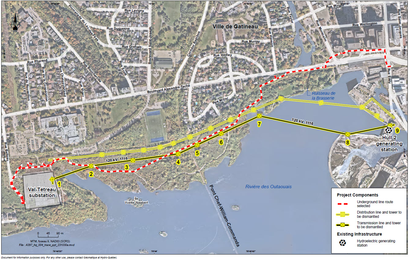
Both current hydro lines are being replaced by an underground one, which is being done to beef up the grid to downtown Hull.

After this project, there's going to be almost no clearing necessary for the new line, which is going to be a huge upgrade.

There's also a new line going from the substation at Gamelin to the island farther north, with a new substation being built next to the cégep on Sacré-Coeur.

Oh this is great. I was secretly hoping for that but felt like it was very unlikely to be the case. Nice to be pleasantly surprised.
 
carte-trace-en.jpg
 
If you're nimble enough to vault over two sets of barricades, you're nimble enough to walk across a snow covered bridge ;) It's a test! If you pass, you can pass!

Yes.


That's been happening all winter. The city should have just given in after the initial outcry over the closure in November.
 
Seems crazy to me that they would interrupt the NCC pathway over and over again like that, with all the dipsy-doos and corners on the western half, when really the yellow shaded north line runs along an unmaintained dirt access road for pretty much the entirety of the western run. Why wouldn't you just follow the flat, straight, dirt road line, rather than thru the bush and rocks and hills and clear-cuts?

 
Seems crazy to me that they would interrupt the NCC pathway over and over again like that, with all the dipsy-doos and corners on the western half, when really the yellow shaded north line runs along an unmaintained dirt access road for pretty much the entirety of the western run. Why wouldn't you just follow the flat, straight, dirt road line, rather than thru the bush and rocks and hills and clear-cuts?

It says on their website they consulted with the Gatineau tram project office so they considered the eventuality of some kind of rail going in the old railway corridor. You can tell from the path they selected they minimized interactions with it, while interactions with the NCC pathway don't really matter since it's underground. It's just gonna cause some short disruptions.
 
It says on their website they consulted with the Gatineau tram project office so they considered the eventuality of some kind of rail going in the old railway corridor. You can tell from the path they selected they minimized interactions with it, while interactions with the NCC pathway don't really matter since it's underground. It's just gonna cause some short disruptions.

They're thinking of running the tram by the river where nobody lives? That project is doomed.
 
They're thinking of running the tram by the river where nobody lives? That project is doomed.

The selected option is to run the tram on the abandoned RoW and then along Lucerne but switch onto Taché around rue Saint-Dominique. Not many people live along that stretch, and UQO can totally be served by a stop where their parking lot and residences are. The hill on Taché is very steep, that's why the old rail line went behind it in the first place!

It also involves lengthening the Rapibus to where it would cross the tram, at the back of UQO's synthetic field.

Yes, its kind of genius actually. Following a rail right of way, who knew!? lol

I didn't know this was still in the cards, and honestly I thought it was going to be on A-T anyways, hill be damned.

When I first saw the clear cut a month ago, I thought the NCC was de-funning the bike path after that guy died on the corner there.
 
They're thinking of running the tram by the river where nobody lives? That project is doomed.

It will go along the river after Montcalm, staying close to built up areas, right behind UQO's soccer field and parking lots before taking Lucerne to Saint-Dominique where it then gets on Alexandre-Taché and Chemin Aylmer. If it stayed along Alexandre-Taché, it would be stuck in traffic. It's not too bad.

You can see the route on the RailFans website:

https://otrain.railfans.ca/system-map

Go to the Map Legend and toggle the STO Tramway and Map Settings if you want satellite view.
 
Both current hydro lines are being replaced by an underground one, which is being done to beef up the grid to downtown Hull.

After this project, there's going to be almost no clearing necessary for the new line, which is going to be a huge upgrade.

There's also a new line going from the substation at Gamelin to the island farther north, with a new substation being built next to the cégep on Sacré-Coeur.

Ah, that's what the treemageddon was all about there this winter or spring or whenever that was.
 
I wonder if it's possible to create a better MUP environment on the top of that power right of way?

A little wider path, and some good sitting-rocks, would be welcome. Maybe even something to replace the shade that was lost along with some of the trees and shrubs. (Used to be a perfect "kissing canopy" in places along that stretch.)

Agreed. At the moment, it's a very narrow path with poor sightlines. It needs some work and more space to take breaks off the path.
 
Agreed. At the moment, it's a very narrow path with poor sightlines. It needs some work and more space to take breaks off the path.

For me, its really just the bottom of the major hill with the 120 degree corner at the bottom, where that unfortunate fellow went over the handlebars into the rocks on the river's edge.

I've also seen families waiting for ambulances after freaking out on the downhill.

There IS a rock and some trees in the way, the path would need to be cut into the embankment to straighten it out.

Other than that, I like that there are glimpses of the water, and there's already a picnic area right there on the point where the guy passed away.

But yes, for the power commuter government worker, a straighter, flatter ROW under the power line bike path would probably be a benefit of a couple minutes and not as many whoopsy-doo hills. Personally the hills are fun for me :)
 
They're thinking of running the tram by the river where nobody lives? That project is doomed.

They're thinking of running the tram by a direct and pre-existing route that serves the downtown core of Hull and its biggest employment node, and a post-secondary institution. That's not doom.
 
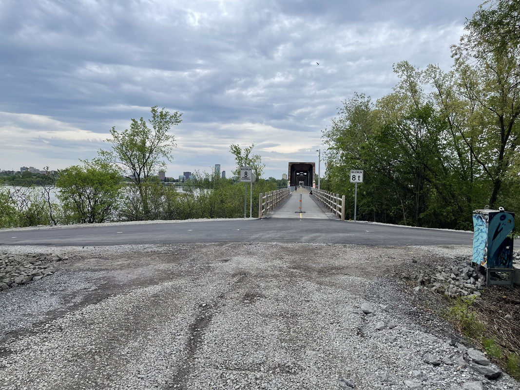
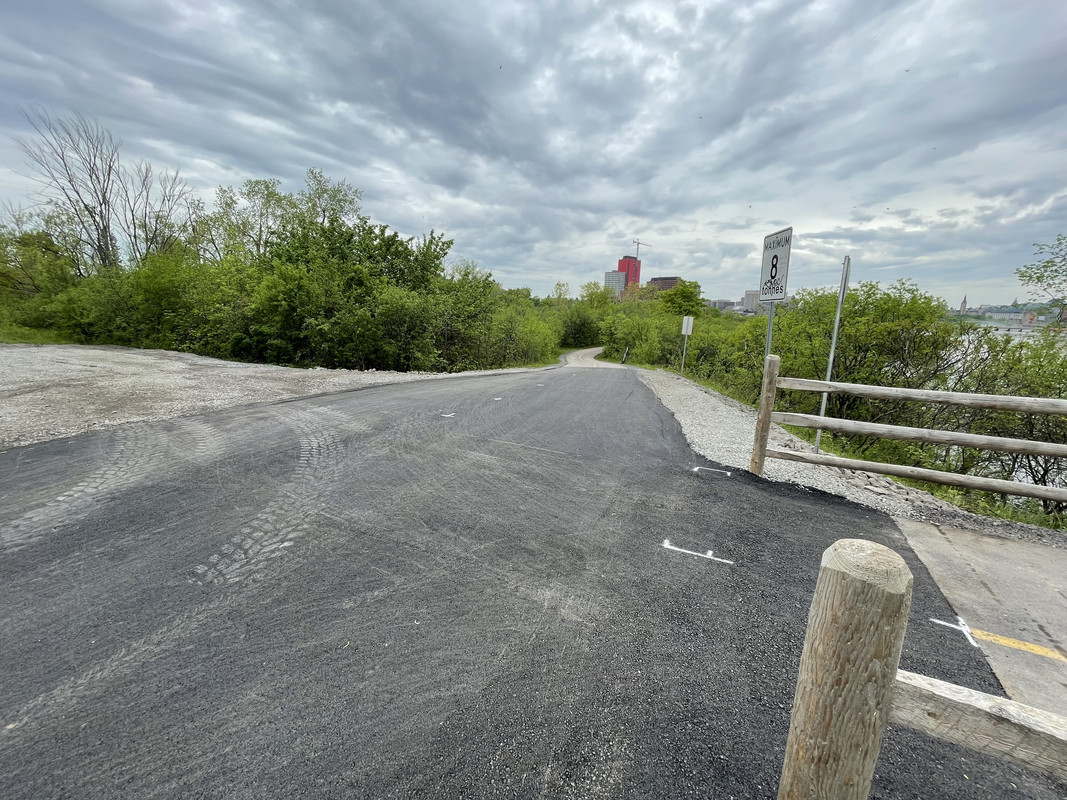
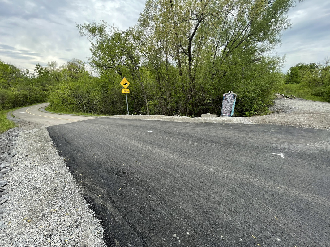
Here’s what the adjusted intersection at the north end of the bridge looks like now. Pathway has been considerably widened and sight lines are improved. They also moved the removable bollard further back so that it’s not a choke point. And not sure if this was just done, but I noticed they removed those two huge godawful signs that were there last summer when it opened. Now there’s just a stop sign going n/b and two signs indicating the max weight heading into the bridge.
Taken May 17
IMG-7267.jpg

IMG-7268.jpg

IMG-7269.jpg


Back
Top