Quote:
Originally Posted by tovangar2

Glover, 1877:
 loc
loc
I wasn't able to locate the demo permit.
The mill must be just out of shot to the right in this post-1886 view (I think the shed, south of the mill, and the tank are just in view though). I kept missing it:
 lapl/wm henry fletcher, n.d.

Note the little arroyo (behind the dark house in the center foreground at the NW corner of 5th and Flower), which carried Los Reyes and the
waste water away from the mill. The waste water was piped under what-was-then Pearl Street (as shown) before being, once again, exposed to the air.
__ |
Thanks for the additional info and images!
I believe the mill's address was changed to 443 S. Figueroa. There are two October 1939 LADBS permits for
a garage at that address; the first permit is for work on the building and then the second one, 18 days later,
is for tearing the whole thing down. Perhaps its condition was found to be too far gone for remodeling.
# # #
This c. 1887 photo was supposedly taken from near 5th and Figueroa. It may show the Woolen Mill Ditch flowing
to the start of the flume that led to the roof of the mill, but the photo might be looking too much to the north for that:
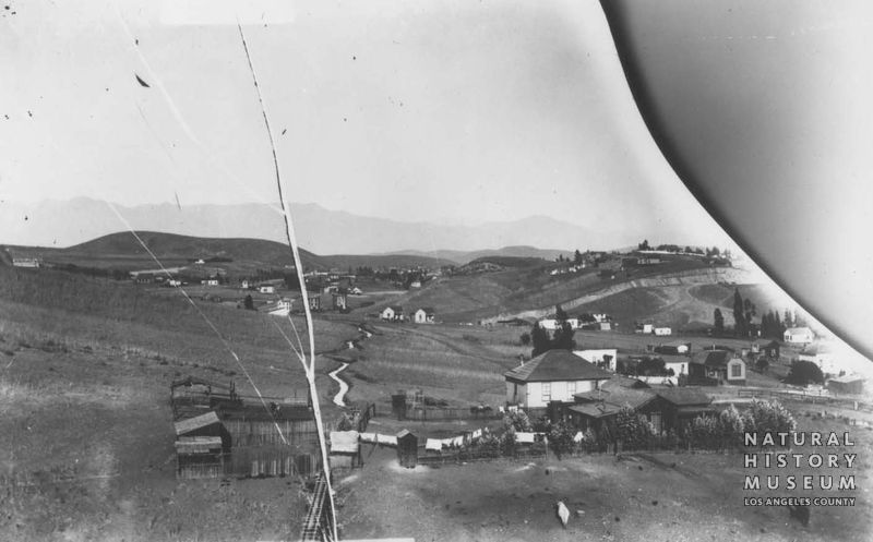
Seaver Center --
http://collections.nhm.org/seaver-ce...&refirn=558426
I am definitely confused about the above photo. Perhaps the section of flume is over a ravine further up the
ditch, rather than the section leading directly to the mill roof in the 1876 photo? If this were the section of
flume leading directly to the roof, I think we'd see the little creek that ran just south of the mill. The long
scar on the hillside in the upper right corner may show 2nd Street after the cable railway was built there.
Here's a closer look at a portion of the above photo. In the middle distance is a prominent sloping hill at the
left side of the red box. On the right side of the box, below the green star, there is a smaller, flat-topped hill
the same shade as the prominent sloping hill. There seems to be a small, partially bare knoll just in front of
the left side of that smaller flat-topped hill:
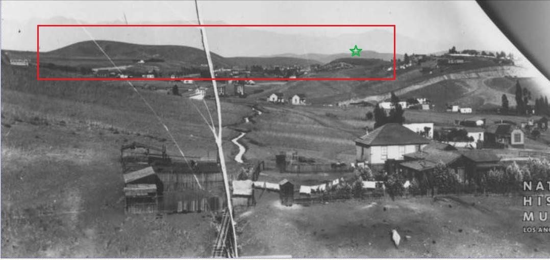
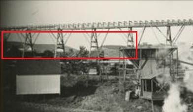
Now here is an enlarged view of a portion of the 1876 photo of the mill. I think we see, lower and from a little
further east, the same prominent sloping hill at left and the flat-topped hill on the right, with the little knoll in
front of its left side:
Anyway, it seems like the 1876 photo looking
across the flume and the c. 1887 photo looking
up the flume show
the same background, and that has me confused. Maybe the two photos show two different flumes on the Woolen Mill
Ditch, or maybe the c. 1887 photo shows not the Woolen Mill Ditch but a different one?
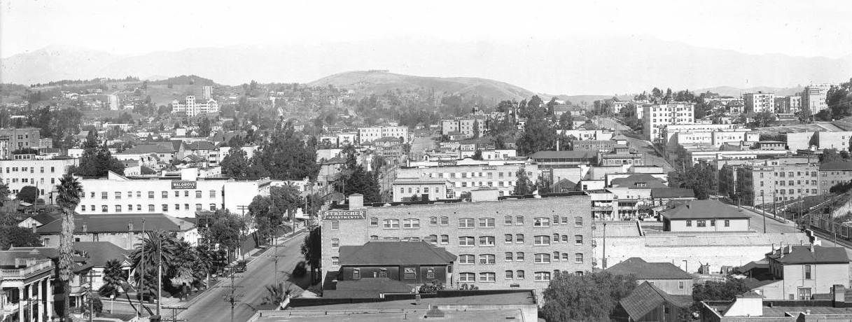
What I've referred to as the "prominent sloping hill" can be clearly seen in the center of the 1916 panorama
I posted before, with the former mill in the lower left corner:
Thanks
er for the 1880 article on the woolen mill. Here is another mention:
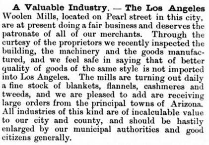
May 1880
Semi-Tropic California @ Hathitrust --
http://babel.hathitrust.org/cgi/pt?i...eq=48;size=175
This reference to the mill and ice house is from the 1886 LA City Directory:
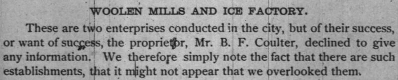
fold3.com