Quote:
Originally Posted by tdinla

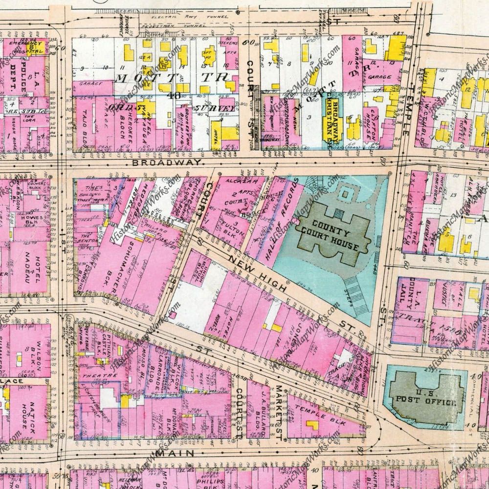
I found old maps of downtown that have court street running uninterrupted to city hall. (Hope I've added images properly)
|
Here's the eastern end of Court Street in 1921, which shows its route before the streets were realigned for City Hall. Although the portion above Broadway is labeled "Court St", that was actually where Court Flight was built to go up the steep incline to the houses above the Hill Street tunnel.
 www.historicmapworks.com
BTW You seem to have used the thumbnail links to post your pictures, although the links at the bottom take me to the full-sized images. You'd probably be better off using postimage's "Hotlink for forums" code in future (and don't forget to credit your sources

)