The hill in the background at right in
er's photo has to be Olive Hill aka Barnsdall Park.
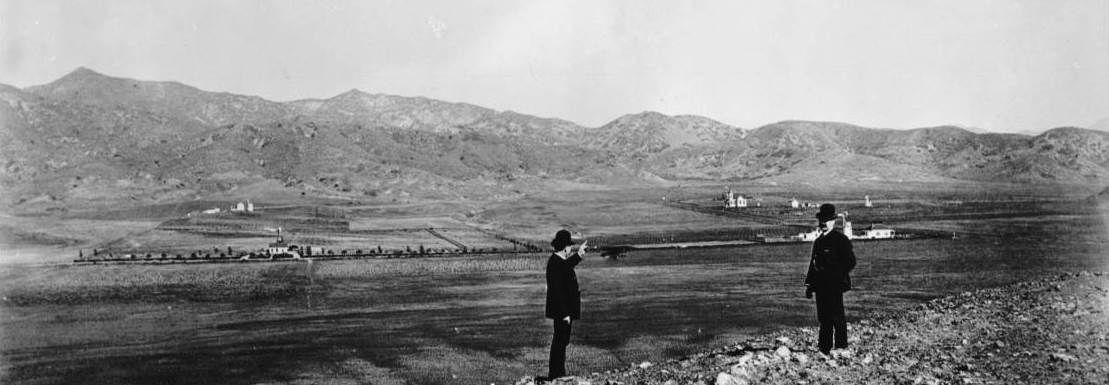
The 1895 photo below looks north from that hill. There's a large house in the distance between the two men (the guy on the left seems to be pointing to it).
Look at the ridgeline from above that house over to the right edge of the photo. Compare that with the ridgeline in
er's photo from the left edge to above the
barn behind the Dwire house. The angle is different, but the two ridgelines match.
USCDL --
http://digitallibrary.usc.edu/cdm/si.../id/1289/rec/3
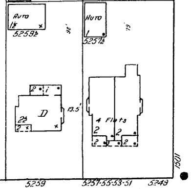
So I checked the north side of Sunset west several blocks from Olive Hill/Barnsdall Park on the earliest Sanborn to show the area (1919). One lot west
of the NW corner of Sunset and Harvard is a 2-1/2 story house with porches on the SW corner and a 1-1/2 story garage/barn in back, just like in
er's
photo. Maybe it's the same house:
LAPL
The area on Googlemap:
https://www.google.com/maps/place/52...50ed82f5?hl=en
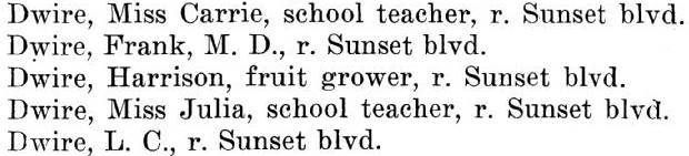
The 1906 Hollywood City Directory has a whole family of Dwires on Sunset:
LAPL --
http://rescarta.lapl.org/ResCarta-We...40507/00000026
P.S. Interesting post on Crossroads of the World,
T2!