Quote:
Originally Posted by Chuckaluck

The Monkey Island Miscellaneous link supports the theory that the street addresses could have been changed. The following is taken directly from that link http://walmart666.blogspot.com/2007/...ey-island.html
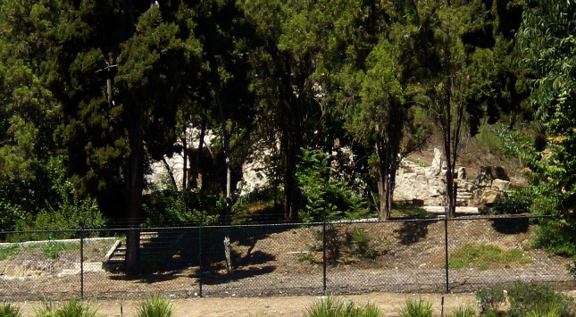
"While the address of Monkey island read 3300 Cahuenga Blvd. the actual address is now a public park with no indication that monkey island existed. There are some interesting foundations just on the other side of the freeway. This closely matched the description of Monkey Island. Its a prime place and ... who knows... the numbering of the streets may have very well changed in the past 80 years. This may simply be the remains of the estate that once was at the corner of Barham and Cahuenga. The interesting thing is that it has a mock hill and a little cave and about a 150 foot foundation.
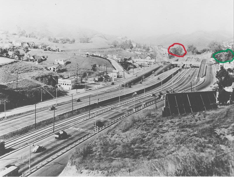
This is a photo of the new Hollywood freeway going thru the Cahuenga pass. (note that creepy bathhouse-esque FANSCAPE building is at the corner of Barham and Cahuenga. its still there. Who knew it was that old!) The red "circle" is the address of Monkey Island and the green "circle" is where I found the mystery foundation on the other side of the freeway. This foundation is inside the fenceline of universal studios. It is not a set. it is clearly the foundation for an outdoor plaza of some sort. There was an estate here at one point but I have yet to find pictures of it.
|
Yes, I read those pages after I first learned about Monkey Island. In the old B&W view above, which looks north towards the valley, I think the area circled in red (now the park) is correct and the one circled in green (also interesting, and worth a little sleuthing some day) is home to some other relic.
The green circled area on the East side of the pass doesn't seem to match the photo but also, it is on a fairly steep slope. I don't see how it would have supported visitor parking.
The little map on the matchbook is a good clue, but that's confusing too because Cahuenga was changed so many times. In the very early days it skirted the west side of the pass, becoming Ventura Blvd. somewhere near Monkey Island. (The older roadway would have been to the left of the red circle.)
The matchbook map shows MI
east of the roadway. In today's world this would definitely put Monkey Island in the green area, but in 1938 (and remember, this place was only there for about 2 years), with the roadway on the west edge of the pass, both the red
and the green areas would agree with the map.
Definitely tricky! I might check an old plat book downtown some day, if I can access it -- that would confirm the location for sure.