Quote:
Originally Posted by HossC

Here's Elza Avenue on the 1910 Baist map. At the time, it looks like it didn't connect with Sunset.
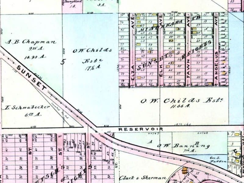 www.historicmapworks.com
Four years later, and two years after e_r's picture, Elza Avenue loops its way down to Sunset
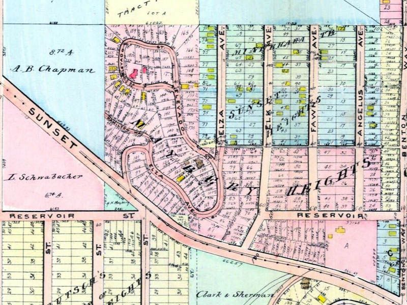 www.historicmapworks.com
 |
Thank you for locating Elza Avenue for me
Hoss.
It's very interesting to compare the two Baist maps. I didn't realize there was an area named "Maybery Heights".
Oh and look at Hamilton Way, and how it just ends at A. B. Chapman's parcel.
__