Quote:
Originally Posted by rcarlton

Station 29 in 1914.
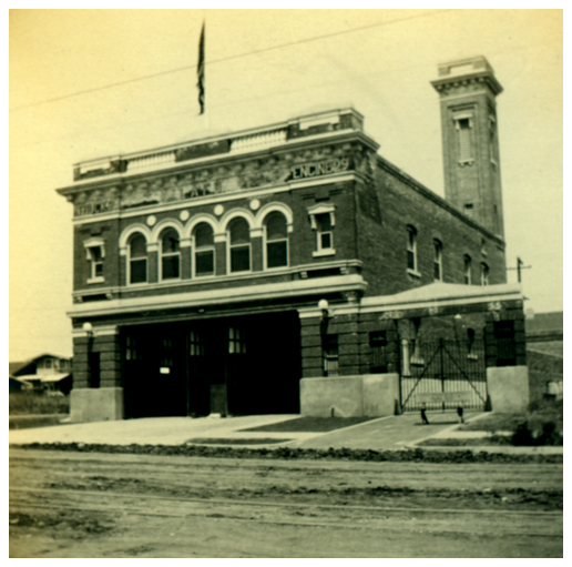 LAFIRE.COM
1991
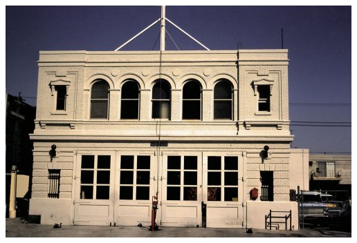 LAFIRE.COM
Here is Station 29 today.
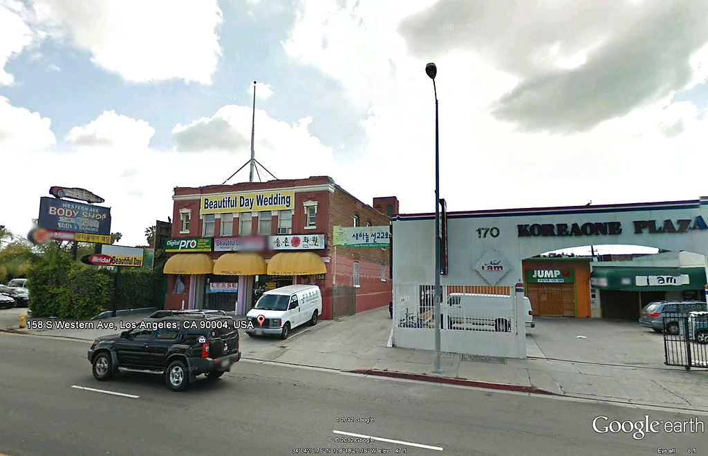 GE
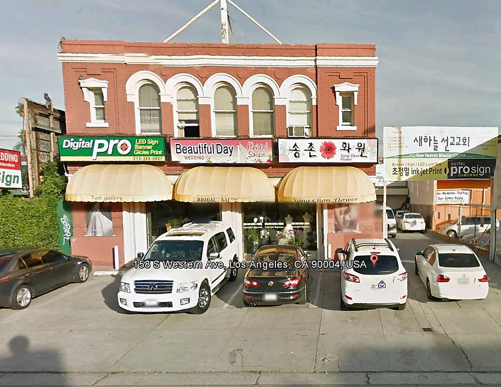 GE |
Per this article (
http://larchmontchronicle.com/origin...or-horses-hay/ ) The station had volunteer "firewomen." I recall reading about the available water supplies on NLA, but maybe not.
From the same article:
Quote:
For a water supply, they used the natural springs in the area such as the one still located at Beverly Blvd. and Oxford Ave. Officially known as the Manhattan Place Volunteer Fire Brigade of the LAFD, Capt. J.A. Caldwell and the matrons renamed their company “The Society Fire Department.”
. . . . . . . . . . .
The area covered by Fire Station 29 includes Wilshire Center, Koreatown, Hancock Park, Windsor Square and Fremont Place.
|
For GW:
Would this fire station have covered Hancock Park, Windsor Square and Fremont Place - when the areas were still being developed, i.e., in the '20s or earlier?
One assumes the article's reference to natural springs at Beverly and Oxford refers to the Beverly Hot Springs. One also assumes that that it is remotely related to a sometimes subterranean "alluvial fan" also known as the Sacatela Slough.
http://forum.skyscraperpage.com/show...postcount=7929
 http://urbandiachrony.files.wordpres...2-35-54-pm.png
Although the answer may appear in this thread,
did areas such as Windsor Square and Fremont Place have their own independent water sources, e.g., a communal spring or well, or did each homeowner have his/her own well? Do any areas in LA proper still obtain their water needs from there own private wells rather than the DWP?
Quote:
Originally Posted by GaylordWilshire
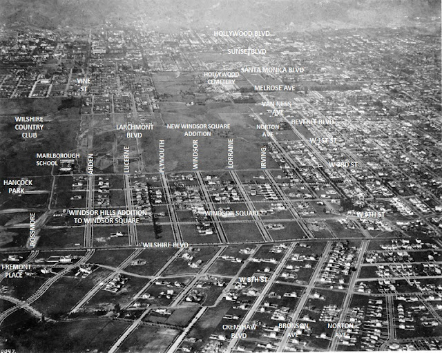 USCDL USCDL
My labels on an aerial that must date from between 1916, when the Marlborough School moved to 3rd Street from 23rd, near St. James Park, and 1920, when the third part of Windsor Square opened (above 3rd St and between Larchmont and Irving, north, more or less, to Beverly Blvd. (Btw, at this point Beverly was still called Temple on insurance maps.)
The north-south line of trees between Plymouth and Lucerne marks the boundary of the first two sections of Windsor Square... somewhere in the noirish past I posted some pics showing how the surfaces of some east-west streets change abruptly at that boundary--concrete in Windsor Square, asphalt in the Windsor Hills addition....
Since I went a little overboard with the labels, here's the original shot...
 USCDL USCDL
(USC has identified this shot as including a view of West Adams. It doesn't.) |
SC's slower format now permits us to revisit earlier posts for easily missed details.
Looking for sloughs and creeks in all the wrong places. And thank you GW, for the street identifications, exploring is so much more interesting with the overlay.
http://digitallibrary.usc.edu/cdm/si...id/4135/rec/78
Sixth Street and Van Ness.


Hilly terrain south of Fremont Place.

