Quote:
Originally Posted by HossC

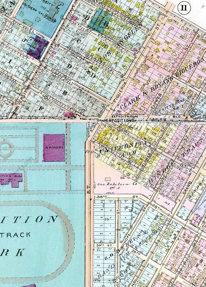
The house belonged to George Zobelein (of Maier & Zobelein's Brewery fame). The picture below dates from 1925 (11 years before the aerial above), and its description says "Exterior view of the Zobelein residence on Figueroa, opposite Exposition Park." As far as I can tell from the 1921 Baist map, the grounds used to extend to Figueroa, hence the difference in addresses. It's right on the corner of four different maps, so I'll see if I can stitch something together. The inset is from the 1936 CD (the same date as the aerial). The house had already been replaced by the current building by 1948 (looking at Historic Aerials).
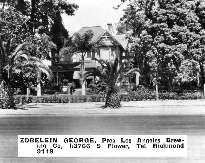 LAPL
LAPL |
It's quite clear that G W Baist never intended for anyone to try and fit his maps together. They all have their own scales, and streets don't line up perfectly from one to the next. Here's the best I could do with four separate 1921 maps around the Zobelein residence. As I assumed in my original post, the grounds of George Zobelein's house once went from Figueroa to Hope Street, and the triangle where Carl's once stood didn't yet exist. Flower Street and Hope Street were both disjointed at Exposition Boulevard, and Flower stopped and started either side of the Zobelein property. The Zobeleins apparently owned the tract below 38th Street as well. It looks like the hall of the Aerospace Museum was once an armory.
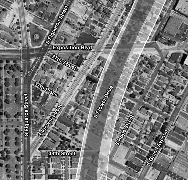
This is how the layout had changed by 1948. The Zobelein residence has gone, but Carl's can now be seen in the triangle. Hope Street has been straightened, and Flower Street has been straightened and extended through the Zobelein property to the intersection of 38th and Figueroa. In the top left corner is the southern end of Hoover Boulevard, which used to go right through the USC campus.
My original post shows a pedestrian subway under Flower and Figueroa which appears to have gone by 1948. The dark band represents the original footprint of the Harbor Freeway, while the light band is the current footprint.
An additional note I found on the Zobelein family dateline on
zobelein.com says
"early 1930's: Zobelein residence is moved to accomodate extension of Flower Street (a few years later the home is razed)".
 Historic Aerials
Another page on zobelein.com
Historic Aerials
Another page on zobelein.com gives the following information:
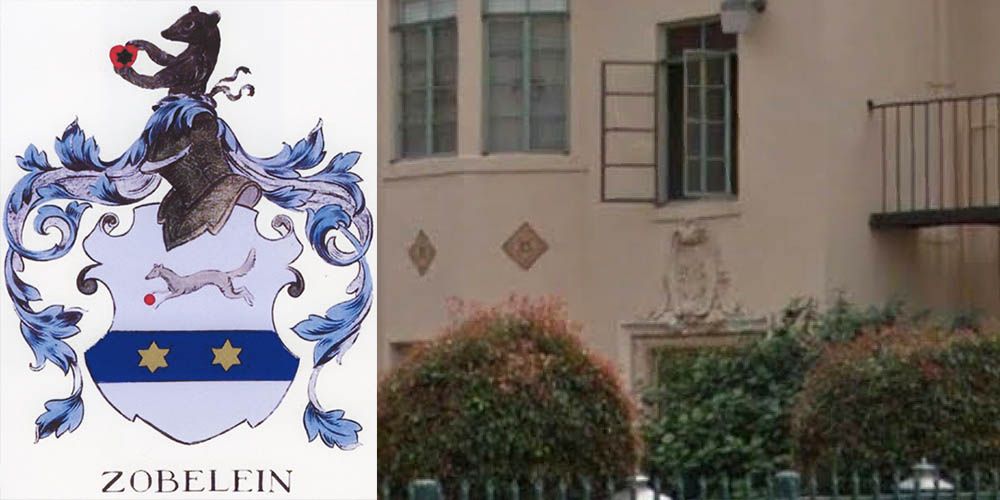
"The German word for sable is 'zobel' - thus the sable incorporated into the coat of arms. This also explains the name given to the apartments owned by the Zobelein family in Los Angeles (on the site of George Zobelein's estate) - the 'Sable Arms'. Above the doorway on the building is a replica of the coat of arms."
This is the building currently on the site, which appears to be the same one that's in all the old aerial images. The Sable Arms Apartments at 3762 S Flower first appear in the City Directories in 1939, and are still there in 1987 (the last one currently available at LAPL).

GSV
Here's the family coat of arms. On the right is the only thing on the building which looked like a coat of arms that I could see from the Googlemobile.
 zobelein.com
/GSV