Quote:
Originally Posted by ProphetM

I was looking for a good pic of the bridge when I came across the page with the photo, because the photo was taken from the bridge. 
And here is the bridge, looking north:
 Also PacificElectric.org
Apologies for the short excursion to Orange County; I grew up in Fullerton until I was 16 and that bridge - long gone by the time I was around - always held a fascination for me. It was local, and yet utterly unreachable. It was gone and so were the red cars, but on top of that I also had no idea where it used to stand as the books that contained the photos of it were too vague to tell me. |
It's hardly surprising that the bridge's location eluded you,
ProphetM. Here it is on a 1953 aerial view (the earliest on Historic Aerials). It looks like Helen's Ice Cream has already gone, and I think the PE tracks may have been taken up.
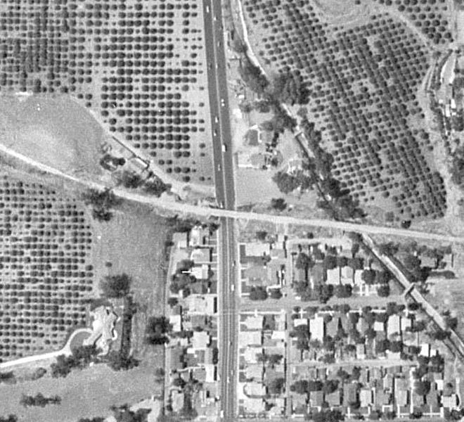
Historic Aerials
The next aerial view they have is 1972, and the area is hardly recognizable. Berkeley Avenue now roughly follows the old route of the PE line on the east of Harbor Blvd, but turns sharply north to the west.
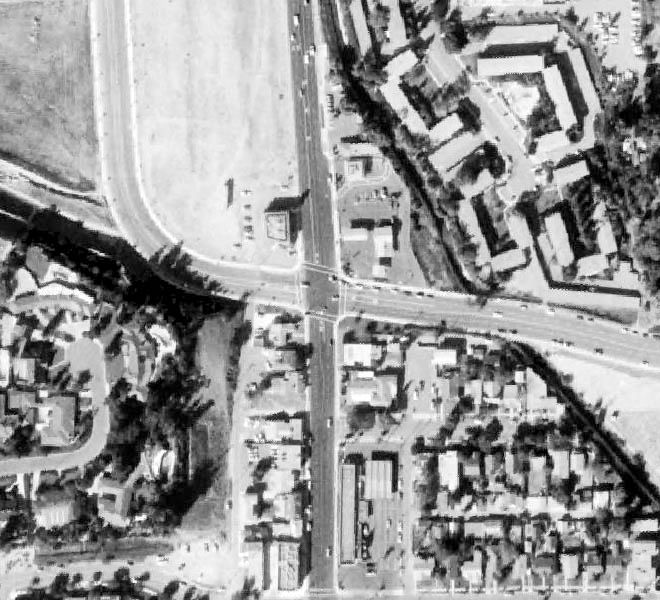
Historic Aerials
The route of the old PE line to the west of Harbor now seems to be the
Juanita Cooke Greenbelt Trail.