Quote:
Originally Posted by Hali87

At one point the pre-war housing would have stretched to roughly where the container pier is now but parts of this area (Richmond) were pretty much 100% wiped out by the explosion and others (Africville) by heavy-handed urban renewal schemes in the 60s. The area around NSIT seems to have been known as "Rockhead" at one point but most of the old buildings are long gone.
|
Rockhead was the city prison that opened in 1854. There was a penitentiary on the Northwest Arm too.
https://haligonia.ca/prisons-of-halifaxs-past-100111/
Here's a map of Halifax from 1890 (showing diptheria cases). In those days development stretched roughly to the northern end of the peninsula but only along the harbour side. Part of the reason why it spread so far in that direction was the rail line. A bunch of major employers were in the far North End like the Oland brewery, shipyard, factories off the Robie spur, and the Acadia Sugar Refinery.
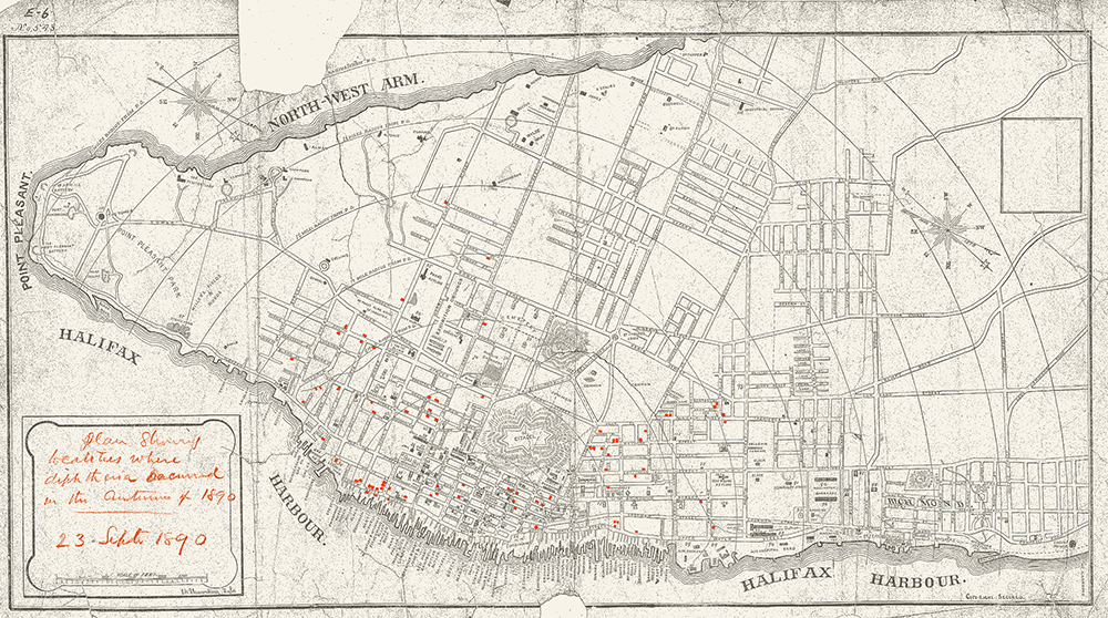
Source
The "city street" area of the West End (Edinburgh, London, Liverpool, Cork St, etc.) is quite old too. These streets were built and the lots subdivided starting in the 1880's or so but took a long time to be fully built out. They only have the odd Victorian-era house. Halifax grew slowly from 1880-1930, then expanded quickly in the 1940's-1960's.
Metro populations (
wikipedia):
1881 - 67,917 (pretty big for 1881)
1931 - 100,204 (not very big for 1931)
1961 - 225,723 (high growth)
Since the 1880's or so, Halifax has gone back and forth as far as being a small or medium sized city compared with other contemporary cities (analogous to Calgary vs. Victoria today).