Quote:
Originally Posted by dmuzika

If a Glenmore extension was constructed, approx distances between Stoney Trail W & Hwy 9 (further east of the city) would be:
- 42 km via 16 Avenue N
- 49 km via Glenmore Trail/Sarcee Trail (approx, depending on alignment)
- 60 km via Stoney Trail
I've attached a map for your reference.
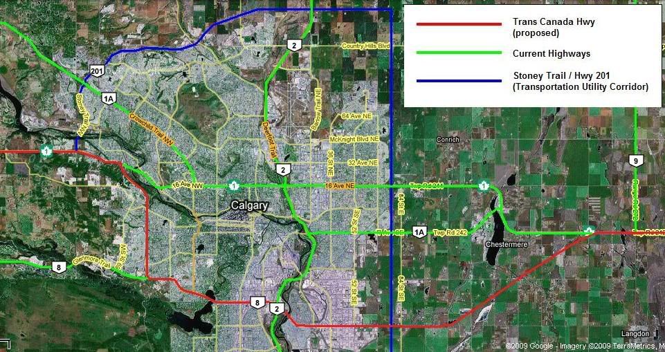
Any thoughts? |
If I had to lay money on the outcome of a Glenmore Trail east extension, I would account for the following factors:
- 17 Avenue SE to Chestermere would more than likely be stripped of its AB-1A designation in favour of an upgraded Peigan Trail;
- Farm, residential acreage, and industrial landowners in the AB-1/Peigan/Glenmore corridors might have a thing or two to say about a straight-line spur connecting AB-1 to AB-8, and would more likely strongly suggest an alignment hewing more closely to the township and range road allowances already in place;
- AB-1 between AB-2 and AB-201 will be upgraded to full motorway standards sooner rather than later;
- ABDoT and Calgary Roads possess a multitude of tools that would make life more than miserable for any non-local or non-tourist driver tempted to drive through the city on AB-1 instead of diverting to AB-201;
- The Glenmore Causeway is a flat-out, full-stop, no-go zone for dangerous goods traffic in the first instance, and a constant bottleneck due to rush-hour commuter traffic in the second instance; and
- The individual segments of AB-1 through Calgary fulfil very different local roles than the one-size-fits-most way of thinking that informed the last round of plans for a Transcanada Motorway back in 1970.
In short, I would expect Peigan and Glenmore to tie into a northish-southish spur of the Transcanada, but not the full-on diversion to Glenmore.