I didn't realize that the house I posted yesterday was home to Richard Simmons. Thanks for the extra information,
CityBoyDoug.
----------------
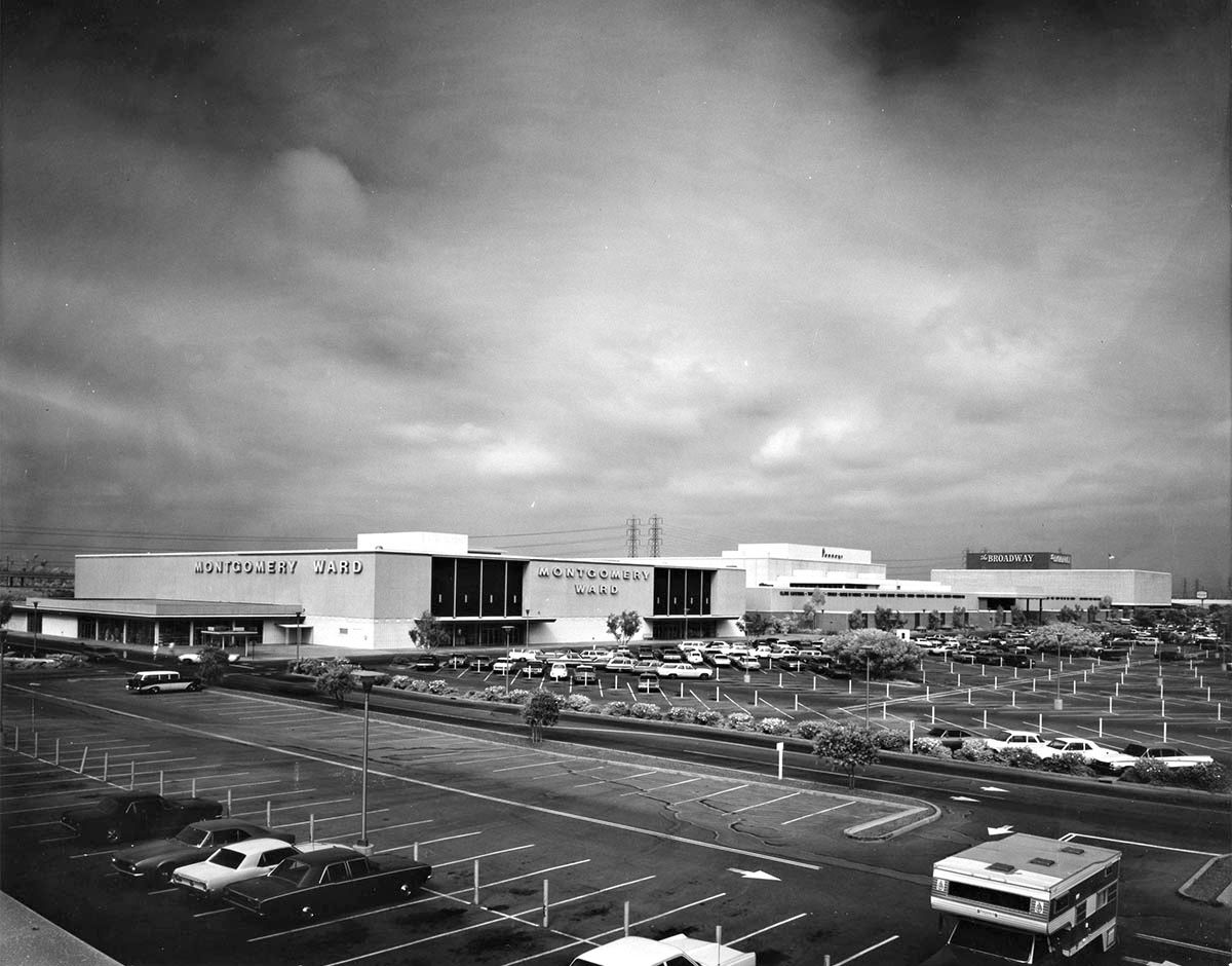
We're off shopping for today's Julius Shulman post. This is
"Job 4550: Huntington Center, 1969". There's a third image in this set that I've omitted - it's a color version of this first photo, but I preferred the contrast in the black & white one.
Here's an interior shot.
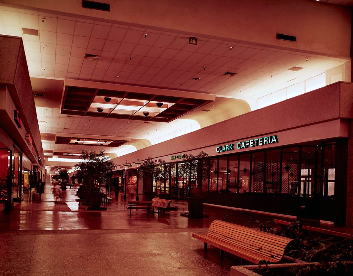
Both from
Getty Research Institute
There's an article on the history of the mall at
mall-hall-of-fame.blogspot.com. I've picked out some details from that article:
"Orange County, California's first fully-enclosed shopping hub was constructed on 58 acres, 33 miles southeast of center city Los Angeles. Originally known as HUNTINGTON CENTER, the complex was adjacent to a newly-opened stretch of the San Diego Freeway / Interstate 405.
The first operational store, a 2-level (156,000 square foot) Los Angeles-based The Broadway, was dedicated November 15, 1965. A 2-level (169,000 square foot) Montgomery Ward held its grand opening October 26, 1966.
Unfortunately, by the mid-1990s, the shopping hub was going under. J.C. Penney moved out in November 1993, with Burlington Coat Factory assuming its store space in 1995. The Broadway folded in August 1996. The mall was left virtually vacant...
Montgomery Ward, vacant since early 2001, was finally demolished in December 2010. THE VILLAGE AT BELLA TERRA, a residential and retail complex, was built on the old Ward's store's 15 acres. Eventually encompassing four hundred and sixty-eight apartments, 30,000 square feet of retail and a 5-level parking structure, its first residential units were completed in April 2013."
The original Montgomery Ward store from the Shulman picture (right) and a smaller one (center) are still visible in the old GSV images.
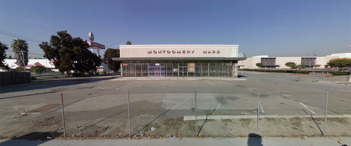
GSV
The current view looks like this.
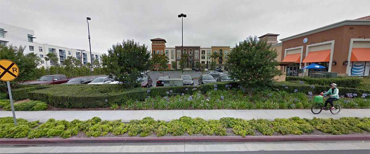
GSV
This is how the whole site looks in a recent Google aerial view.
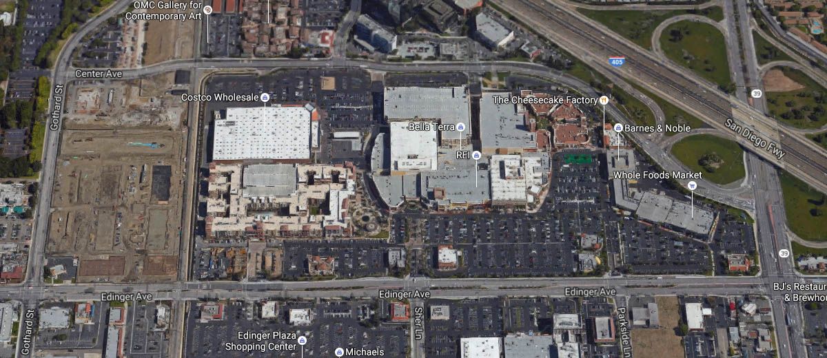
Google Maps
Just for fun, I thought I'd go back in time with the views at Historic Aerials. Some of the original buildings are still standing in this 2010 image.
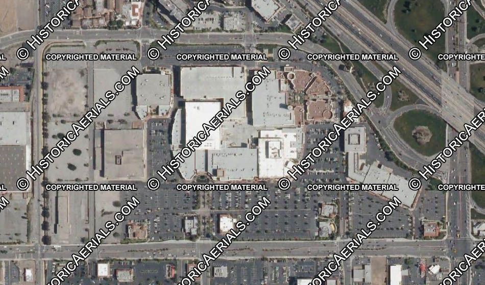
Historic Aerials
I'm assuming that this 1972 view shows the mall pretty much as it is in the Shulman images.
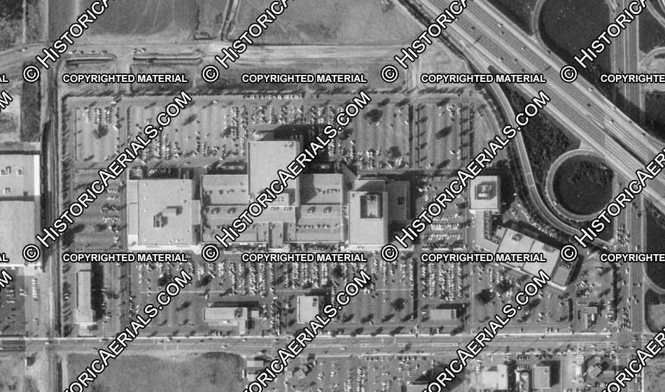
Historic Aerials
Two years before the first stores opened, the area was just fields. Very early work in the San Diego Freeway interchange can just be seen in the top-right corner.
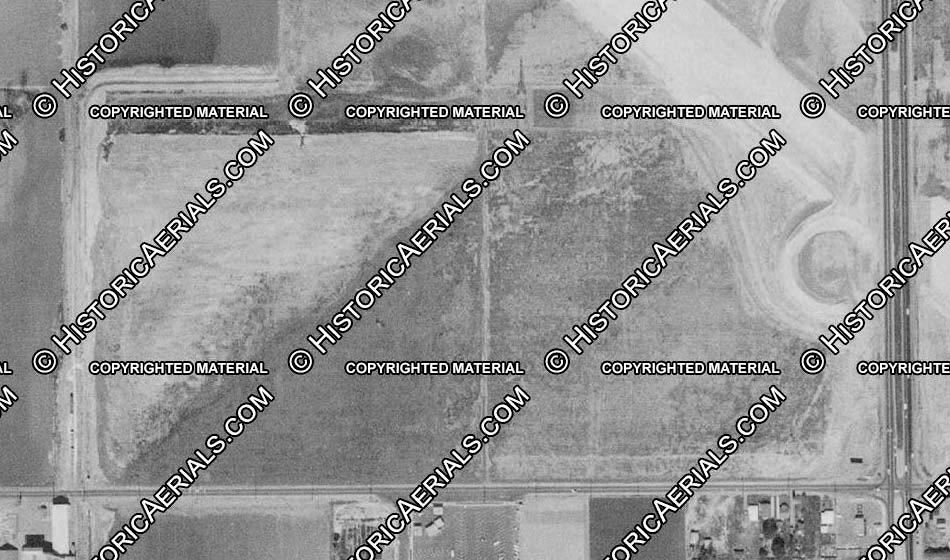
Historic Aerials