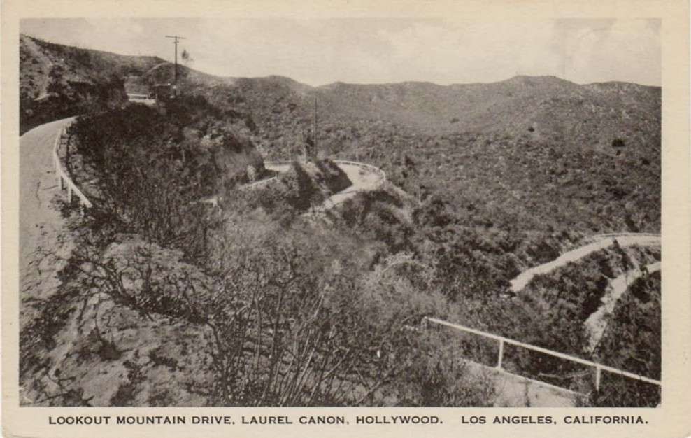
Quote:
Originally Posted by ethereal_reality

Lorendoc, I also had this in a file but hadn't posted it yet.

Is that a bow knot in the center?
__
|
Thank you
e_r for the reverse angle picture of "Double Bow Knot Boulevard. It looks northwest towards the high north-south ridge that separates Coldwater Canyon in the west from the Wonderland bowl and Laurel Canyon to the east. This ridge, a kilometer long, is anchored on each end by a prominence having the same elevation of about 1550 feet. It is the highest land between Laurel Canyon on the east, Mulholland Drive on the north, Coldwater Canyon on the west, and Sunset Boulevard on the south.
The northern promontory is today occupied by the 300' tall KCRW-KYSR Broadcast tower at 2555 Briercrest. (For more about this tower, see
http://www.earthsignals.com/Collins/0017/). The southern promontory I believe is Wulff's Peak, as the contemporary real estate ads and newspaper would seem to suggest.
Here is the 1924 topo map with the north and south prominences of the high ridge marked on the map:

The two lines of evidence that this southern knob is Wulff's Peak are 1) the newspaper articles all describe the ascent of Wulff's Peak as starting from Laurel Canyon via the Double Bow Knot Road and Upper Crescent Drive, ultimately to an altitude of 1500+ feet and 2) the northern knob with the later transmitter could only have been accessed from Coldwater Canyon at the time the topo map was made. BUT: confusingly, the FCC description of radio towers at Wulff's Peak state their location as "Lookout Mountain," which is almost certainly wrong.
Back at Double Bow Knot Boulevard, I made an overlay of the 1924 topo on top of the current street map from Google, to indicate on the latter the relationship of DBKB with the current street pattern:

DBKB is indicated by black dots. The grades, at least the upper ones, are still there after 100 years of erosion and regrading. And it is very clear that upper and lower Crescent Drives did connect.
While I am reasonably satisfied about the location of Wulff's Peak, I am not so sure about where Wonderland Point and Lookout Mountain and the Lookout Mountain Inn were.
e_r's photo showing Wulff's Peak and the "proposed" scenic railroad that he said were from a 1895 newspaper advert actually was from the
Los Angeles Herald on May 30, 1909. I am going to the LAPL Central branch tomorrow and I will see if I can get a better reproduction; the photo purports to show Wonderland Point and other controversial locations. One thing it would *not* show is the Lookout Mountain Inn, because that was not built until 1912. More to follow - and again I want to express my admiration for the expertise and commitment to accuracy that posters to this thread show every day.