 http://www.lapl.org/
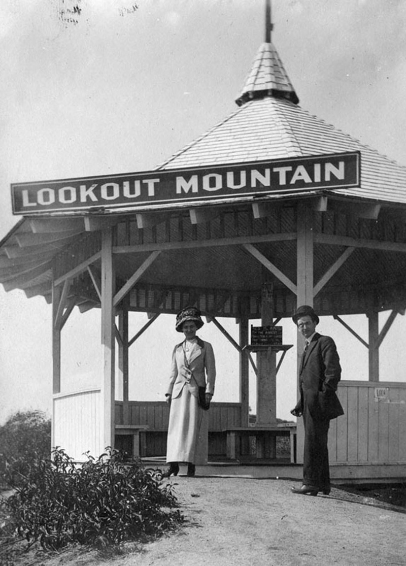
Unfortunately, this remarkable place was very short lived.
http://www.lapl.org/
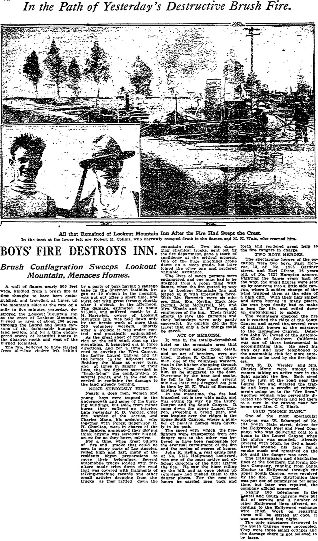
Unfortunately, this remarkable place was very short lived. On October 27, 1918 the Lookout Mountain Inn was totally destroyed in a fire. As the L.A. Times explains below, the blaze was blamed on "glowing embers left behind by a party of boys having a sausage bake in the Sherman foothills".
 http://search.proquest.com/hnplatime...ccountid=11124
Like I said in my first post, the few sites that mentioned the Lookout Mountain Inn were unclear about its location and what took its place.
http://search.proquest.com/hnplatime...ccountid=11124
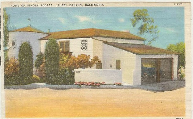
Like I said in my first post, the few sites that mentioned the Lookout Mountain Inn were unclear about its location and what took its place. A February 27, 1927 Times article announced the completion of a $30,000 mansion "at the summit of Lookout Mountain" for ad executive Chet Crank, and a myth has spread the this amazing mansion, at 8782 Appian Way, is old site of the Inn.
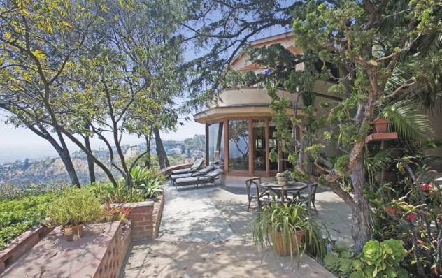
There's another layer to this, stemming from the purchase of this property by Lew Ayres, husband of Ginger Rogers and star of All Quiet On The Western Front, Young Doctor Kildare, etc. Some websites call 8782 the Ginger Rogers house, and one (
http://takesunset.com/2010/06/ginger...canyon-estate/) even claims that the house was built for her and Lew in 1927. Pretty unlikely since Lew was then 19, Miss Rogers was 16, and they weren't wed until 1934!
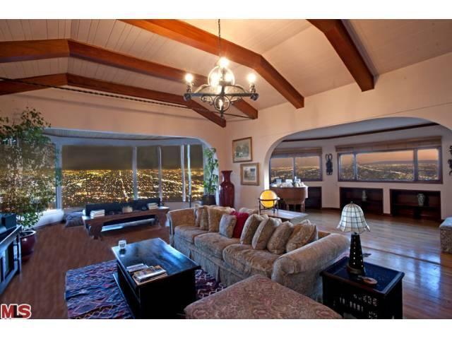
Regardless of when they moved in, and whether Ginger Rogers ever lived there, it is a stunning home. Before moving on, here are some quick photos:
 http://takesunset.com/2010/06/ginger...canyon-estate/
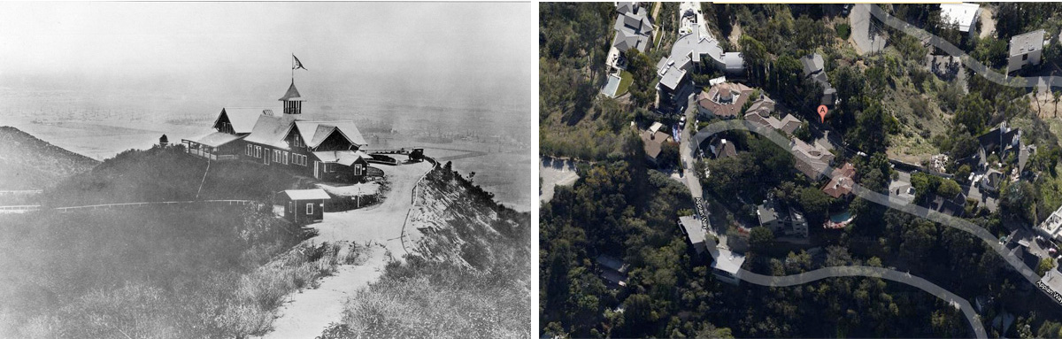
I spent two afternoons hiking all around Appian Way and tried to picture the Inn at this spot, but it just didn't feel right. Mostly, I was bothered that 8782, the dark gray structure almost hidden behind the A, was on the down slope side of Appian Way, not on the plateau. It's hard to tell much from the satellite image, but the contours of the hill didn't look right to me, or the roads leading up to it. And the lot faces Beverly Hills, not downtown. Here are the images, so you can see what I mean.
Next stop was the L.A. Central Library. To my surprise their L.A. history section had very little on Laurel Canyon, but a book called Hollywood Then And Now had one major clue -- a "now" photo of the Lookout Inn site. The author didn't give the location or street names, but the "now" photo showed a big electrical tower. There are only a few such towers in the area and by following the path of the high voltage wires in Google Satellite I was able to find the same tower and thus the original site of the Inn.
Here's a larger version of the original photo, followed by a panoramic shot I took a few days ago:
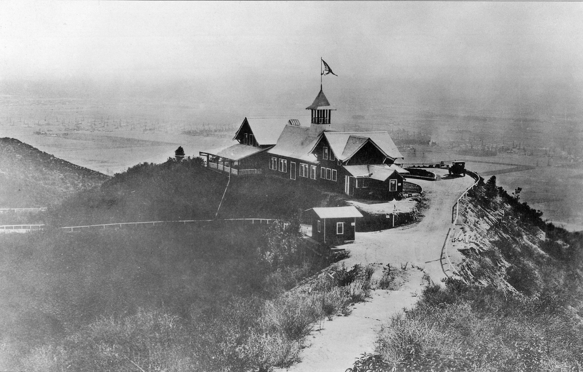
It was hazy when I took this photo, but on a clear day one can see Hollywood, mid city, and downtown, just like in the original photo.
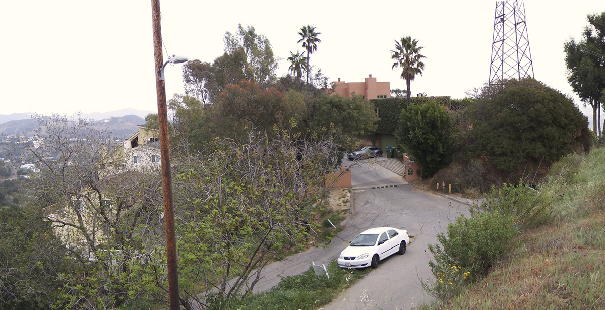
The hilltop site was re-graded and the summit road was realigned. The old white fenced road on the left that slopes down to the east was moved to the top of the hill, At the gates and the speed bump it becomes a private road for one block and then connects with the old Cole Crest Drive, which continues east. There is also a short private road to its left -- hidden by trees, behind the wooden phone pole. Moving the main road and adding the other spur road allowed the property to be divided into more lots.
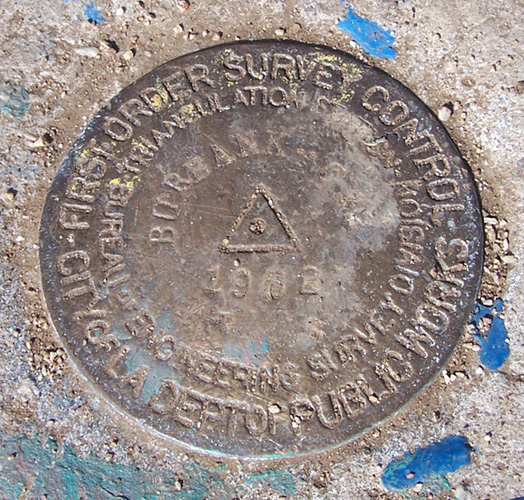
The dirt road in the foreground is now McLeod Drive, which winds around to the back of the hill that overlooks the Inn site. This hill is near where the photographer stood when the old photo was taken and is in fact the summit of Lookout Mountain, as indicated by a survey marker. I'd bet that guests at the Inn often took this 10 minute walk up this path to the summit. The smaller road on the passenger side of the white car looks like it was just a trail in the old days, but is now the eastern end of Blue Heights Drive, overlooking Brier Drive and Walnut Drive.
Finally, we have the road that curves off in the right foreground. It's barely visible in the older photo, but the direction of the fence shows that this was indeed a road in 1927. Today this is the other side of Blue Heights Drive, which intersects with Sunset Plaza Drive, about 2 blocks west.
Here's a small Google map of the area. The large black square marks the Inn site and the small one indicates the summit. The red square indicates 8782 Appian Way. (I believe that the Blue Heights Drive label is incorrect -- I think it should be overlaid upon the unlabeled road to the left.)
 http://www.google.com/
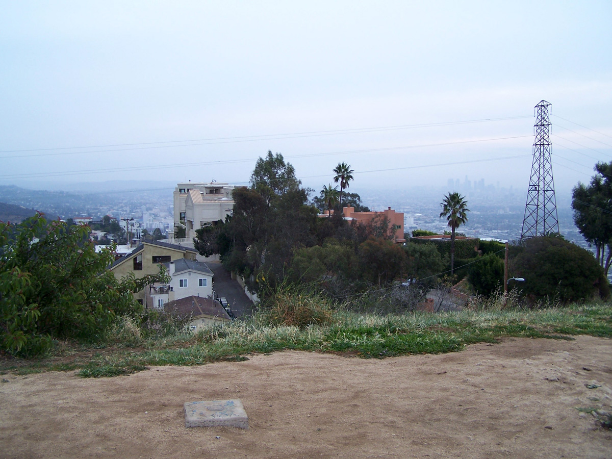
The actual summit, with the Inn site in the background.
http://www.google.com/
The actual summit, with the Inn site in the background. Downtown L.A. can be seen to the left of the tower.
 The summit marker.
This is probably a good stopping point for this post but there's more, if people are interested in additional photos and details about the area. I'm still trying to identify some the old roads and will post about them later.
TO BE CONTINUED