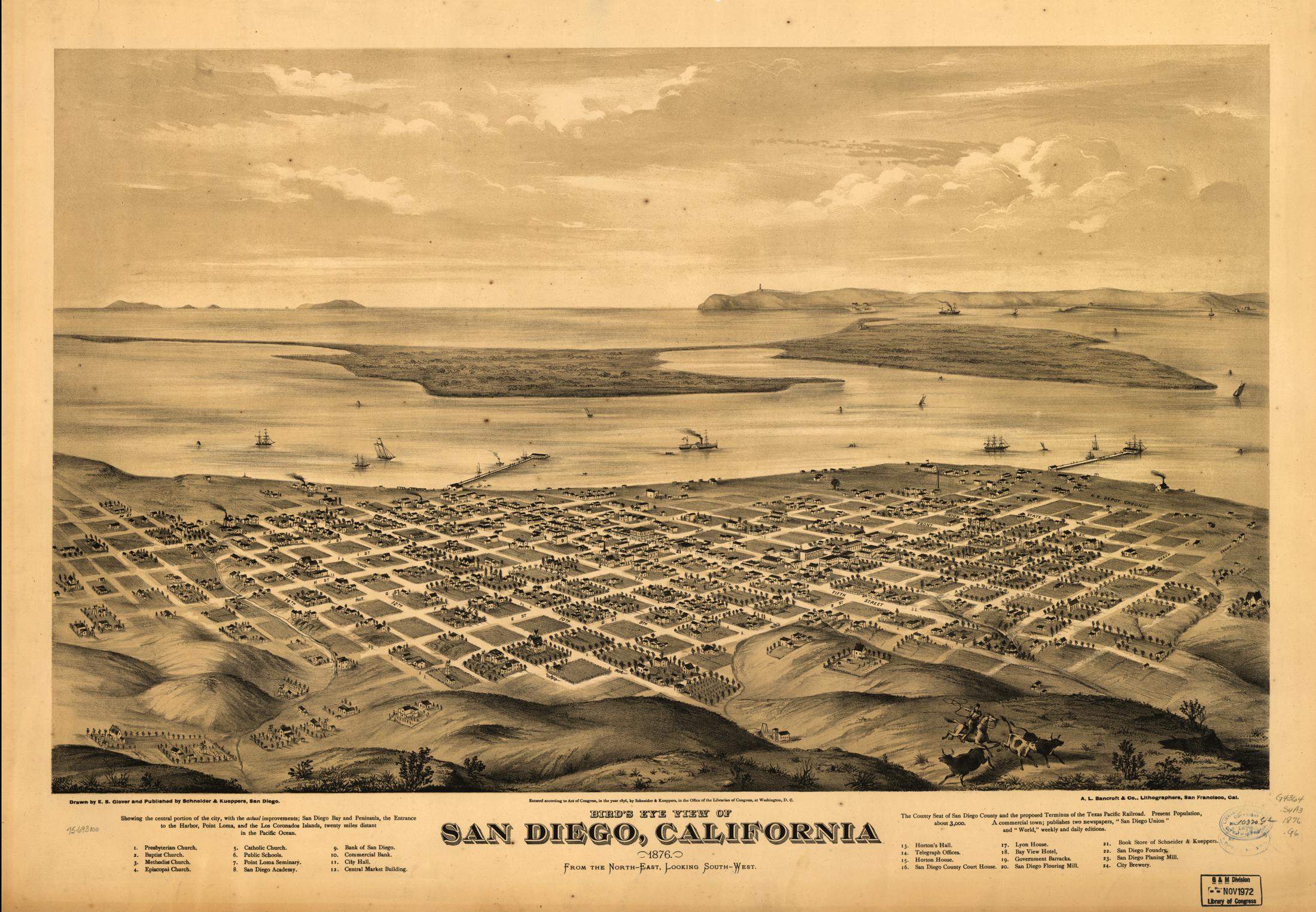
For a change of pace, how about this map of downtown circa 1876. I just love all the
detail. (warning: large image)
The city is depicted from Balboa Park, and for reference the view to very similar to what you see today while coming into land at the airport. As far as I can tell it was commissioned to draw up support for extending the southern transcontinental railroad to the harbor, which would have made San Diego the port of entry for all of southern California. Unfortunately geography dictated the railroad swing north to Los Angeles instead, which lead to LA becoming the region's commercial hub instead.

Here's a photograph taken in that same year. The pier terminated near the trolley station in the Gaslamp District, everything beyond was dredged out of the harbor in later years.