Quote:
Originally Posted by Keith P.

Great work, OldDartmouthMark!
Seems a shame to have most of that old ROW used simply for parking. Imagine a transit rail terminal just a bit south of your red circle on the last image to allow people from the suburbs to commute downtown and back again. Given the paranoia about security one doubts even an elevated line would be permitted to run over those lots now. What a shame.
The City archives has what seems to be tons of photographs that are not yet scanned. There was a reference to a treasure trove of pictures in the Planning and Development office files related to the development of Scotia Square. Many of them seemed to be of the area before demolition. The index is available digitally but not the pictures themselves.
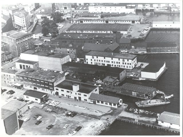
I did find this one of the waterfront pre-Historic Properties with our old friend the Pentagon Building making another appearance. Interesting to see the area immediately adjacent with a number of large trees, could it have been a park of some sort? Seems odd.
 |
Here's a pic I found around the time of the Cogswell development of the area from a different angle. Notably gone is the pentagon bldg., and the area that appears to be a park in the above pic is in the foreground.
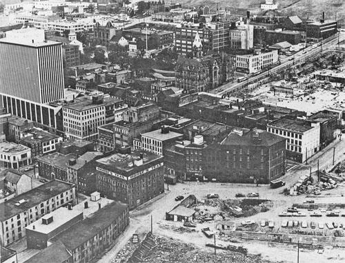
I also noted the unfamiliar view of the old RBC tower without 1801 and the BMO tower blocking it off.
http://www.historicplaces.ca/en/rep-...spx?id=1614#i2