Quote:
Originally Posted by IWant2BeInSTL

And an aerial view of our Mill Creek Valley post-clearance. See Centropolis' post above. This is looking east from midtown—note Union Station in the upper right corner:
 Source
 |
and of course pruitt-igoe up in the upper left side. see: philip glass.
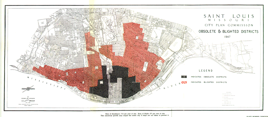 http://preservationresearch.com
most of the "obsolete" districts were wholesale removed, severely altered with expressway construction, or saw industrial/ commercial redevelopment. in 1947 much of the area referred to as "blighted" on the above figure was just mixed-use in a way that the planners were uncomfortable with. the forlorn north side (the right side of the figure) was actually the more contigously urban and older quarter of the city. it's also interesting how they spared the central west end - the residential seat of power around forest park.
at the end of the day, the city government/planners were able to do things that robert moses probably could have never got away with, and were almost certainly on some kind of power trip.