Quote:
Originally Posted by FredH

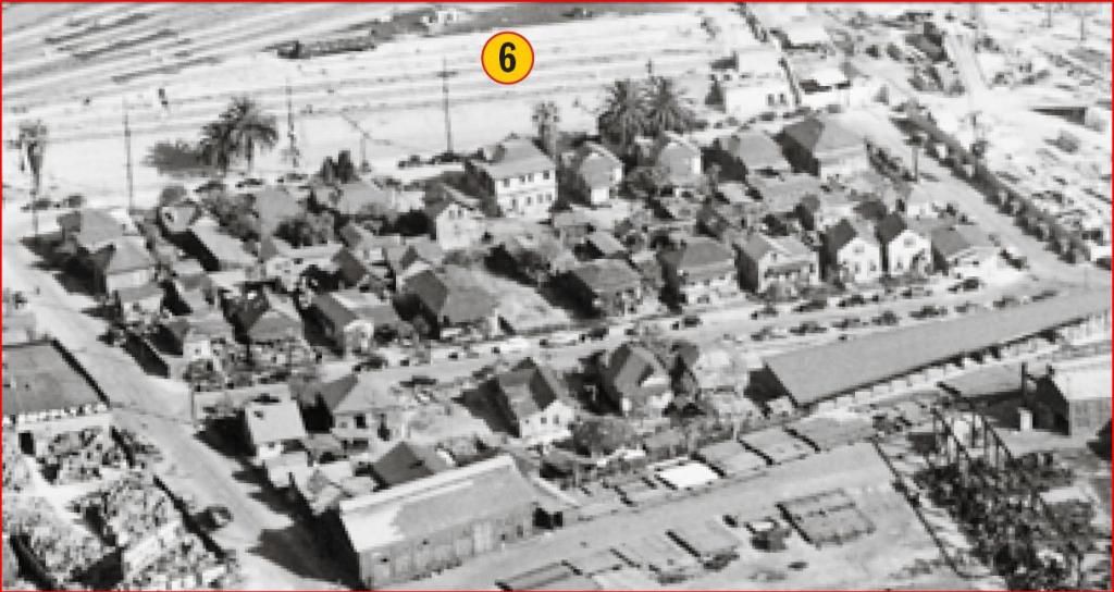
A couple weeks ago, ER found this great series of aerial photos from the 1930's. I noticed something interesting in this one that shows Union Station.
Just north of Union Station is a small housing tract I never noticed before. Does anyone have any information about this area?
 http://ctr.trains.com/~/media/Files/...930s%20BEV.pdf
 |
I originally saved the map below after I found a picture of James Cuzner's house on S Harvard Boulevard in the USC library. Luckily, I searched NLA before doing too much more research, and found that
Flyingwedge had beaten me to it in
post #19399. The residential area in question is the Kerckhoff Cuzner tract, which was right next to the Kerckhoff Cuzner lumber mill. Back in 1921, there was also housing to the east of Date Street (in reality, Alameda is almost north/south at this location), most of which got taken out when Union Station was built.
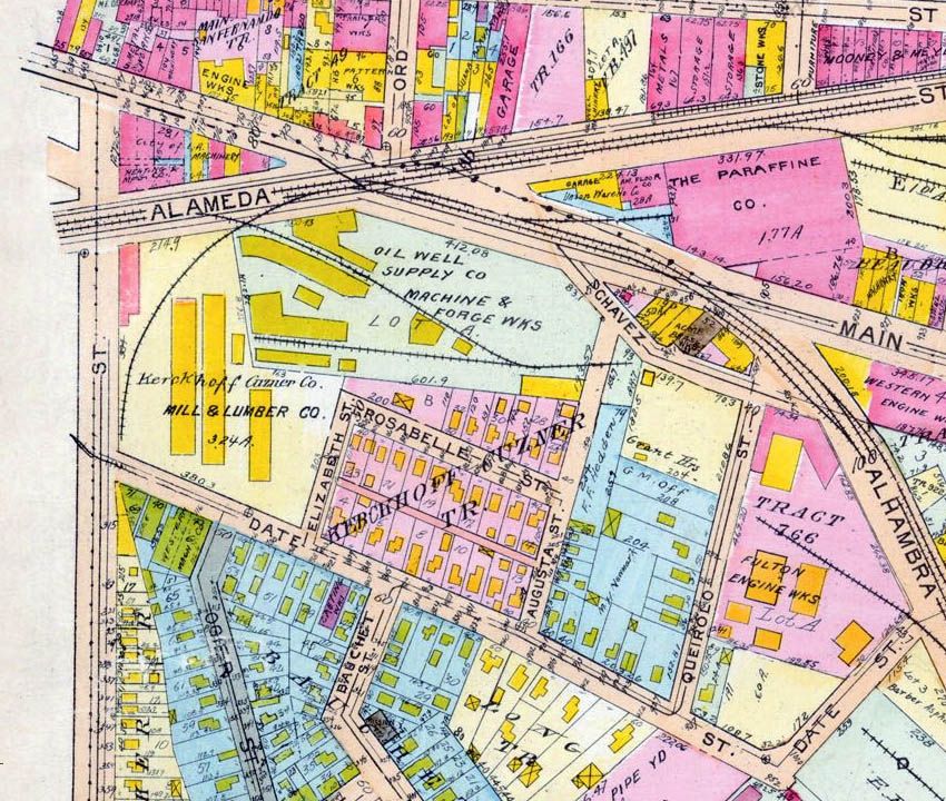 www.historicmapworks.com
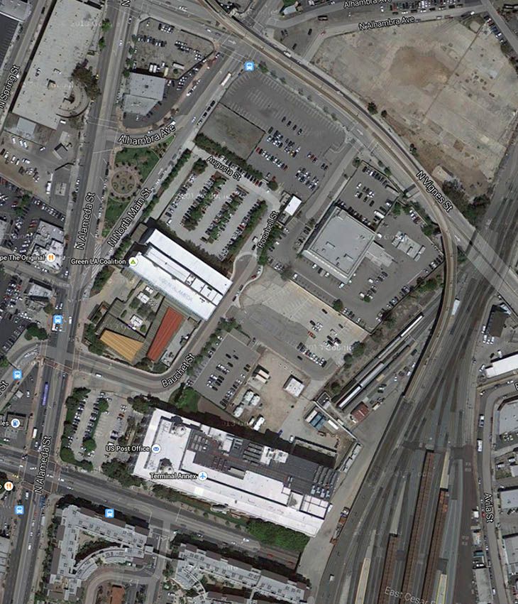
The street layout to the west of the rail tracks is still recognizable on this 1948 aerial, even though there have been several changes. Probably the biggest changes are removal of most of the industry (the Oil Well Supply Co and the Kerckhoff Cuzner lumber mill), and the appearance of the Terminal Annex building. Rosabelle, Elizabeth and Augusta Streets are still visible, but Date Street has been severly truncated. Access to the area is now from Alameda via Bauchet Street, which previously only went east from Date Street.
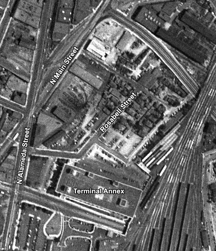
Historic Aerials
Just four years later, and all the housing has gone. The old streets can still be seen, but they just have parking lots between them.
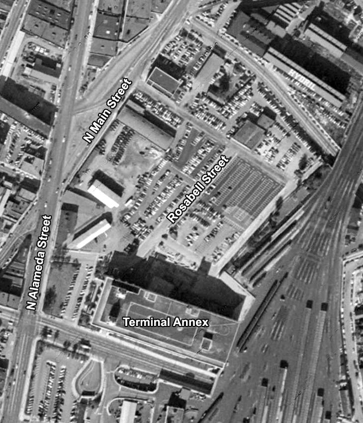
Historic Aerials
Looking at the current view, Bauchet Street has been slightly realigned to meet the intersection of Alameda and Main Streets. Rosabell and Augusta Streets still exist, although pretty much in name only. All other traces of residential streets and houses have gone.
Google Maps
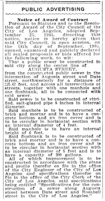
I haven't come across many references to this area. The clipping below is from the October 2, 1905 edition of the Los Angeles Herald, and gives notice of sewer construction around Augusta Street.
 California Digital Newspaper Collection
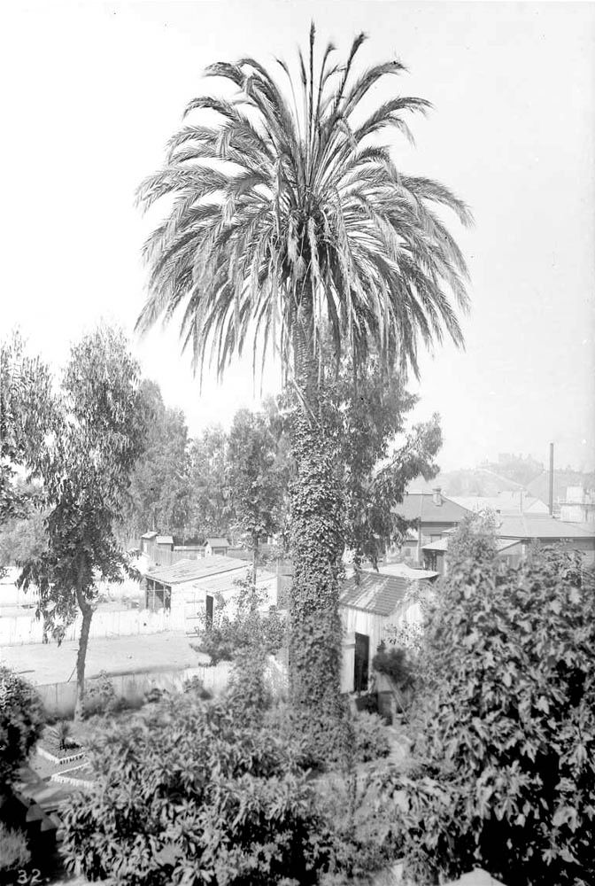
Slightly off the original topic, but USC have this picture described as the
"Oldest date palm in the city of Los Angeles on Date Street, ca.1888". Given the age, I'd guess we're talking about the same Date Street.
 USC Digital Library