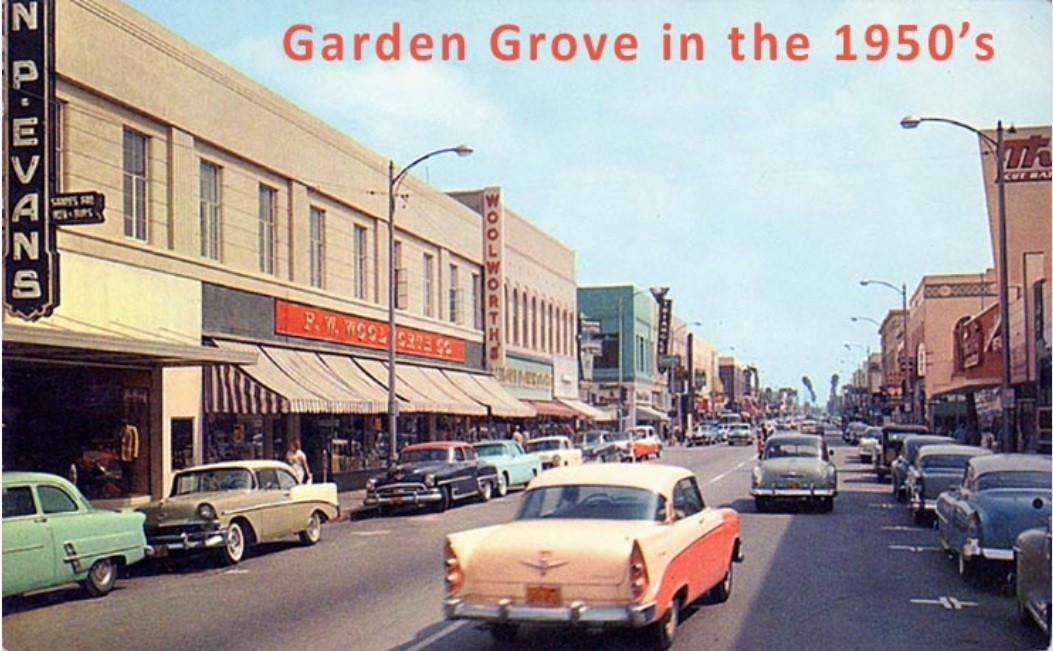
Quote:
Originally Posted by ethereal_reality

I don't believe we've seen this particular photograph. (there's a similar one on waterandpower, but this one is much better)
"Sunset at Broadway. Downtown Los Angeles. June 4th, 1948."
 Metro Library Archive, Flickr
 I don't recognize the building at far left. The other three are icons.
I just noticed the two streetcars passing each other on the curve.
______
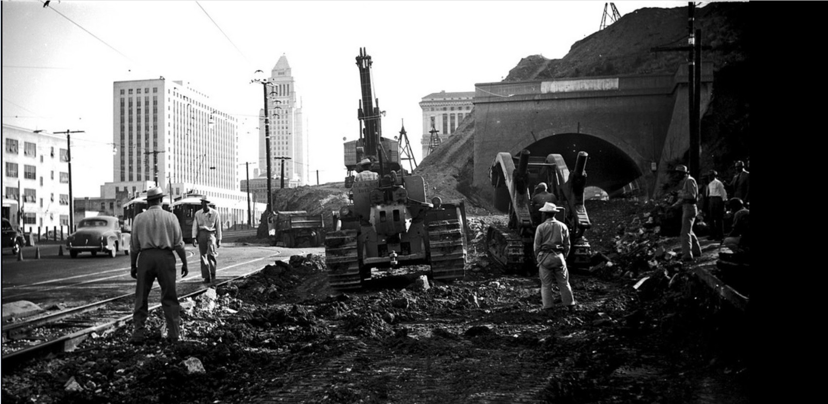
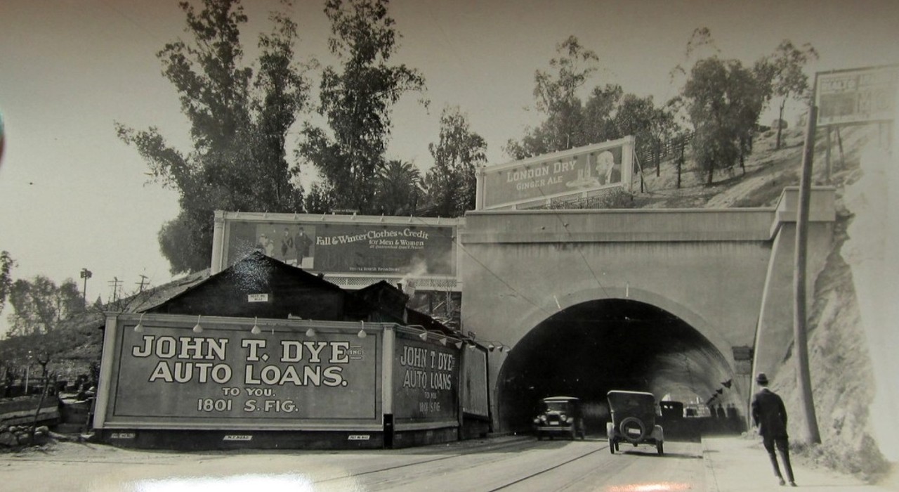
below: Here is a view of the tunnel 22 years prior. |
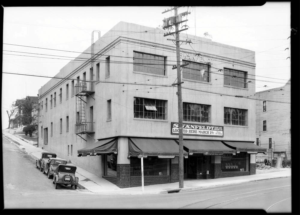
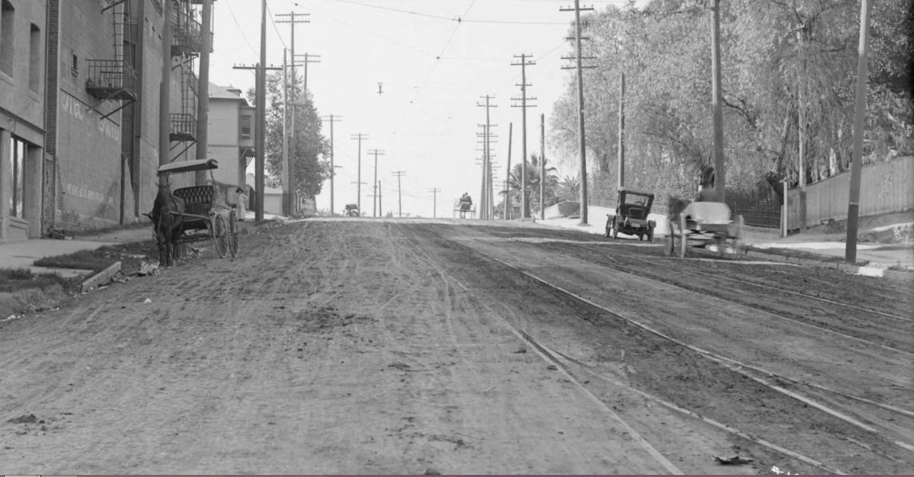
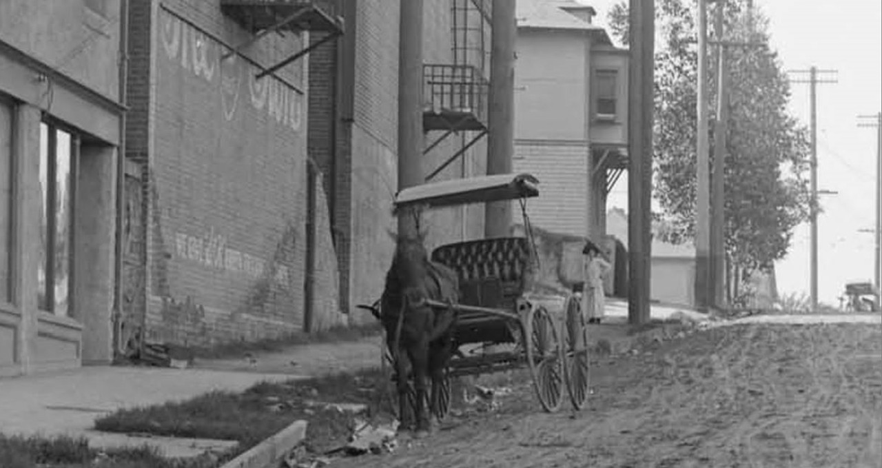
First I feel a little uneasy with the date on your image. I feel like it's perhaps a year too early. Be that as it may, the building is one of the Brunswig Drug Co. annexes although by this time
it's actually been pressed into service as a temporary address for some of the Municipal/Superior courtrooms displaced by the loss of the County Courthouse (in '33-35) and the subsequent wholly
inadequate 'temporary' buildings on Poundcake Hill.
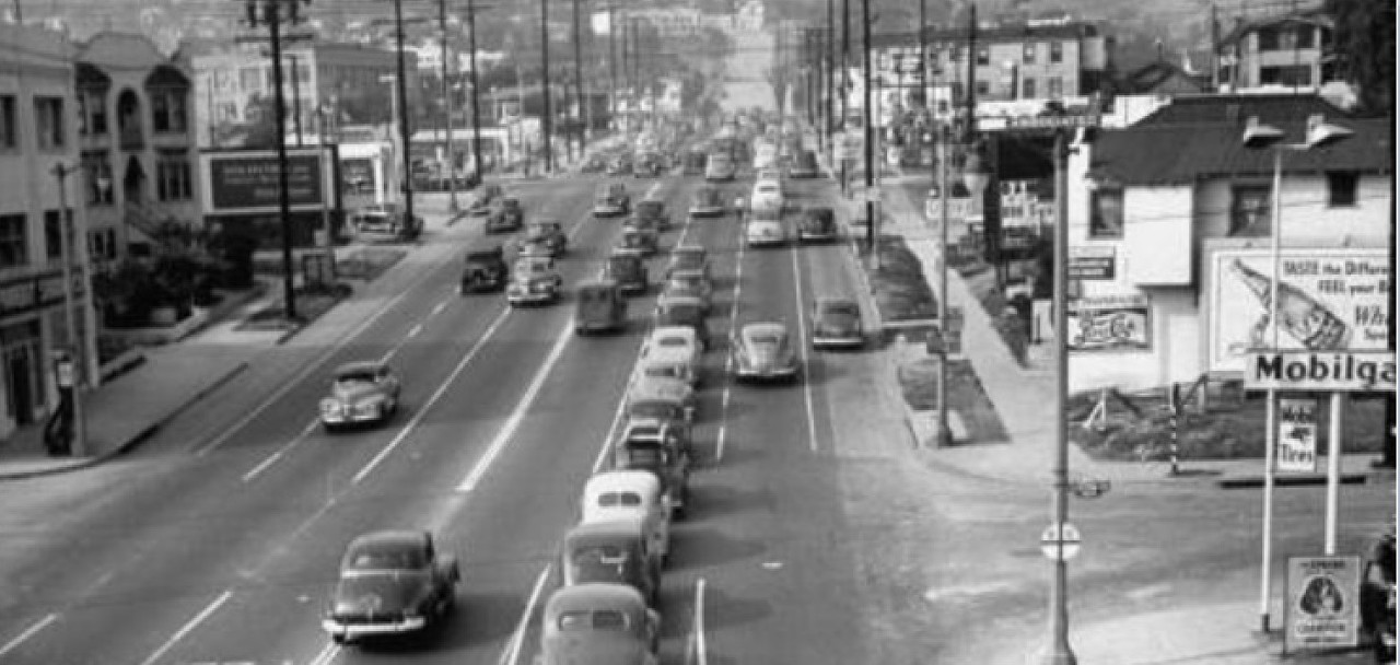
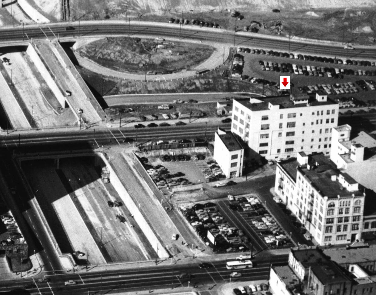
 Looking east across Spring Street from Fort Moore Hill, 1949
Looking east across Spring Street and New High Street (partially hidden behind this stand of trees near the bottom)toward Union Station from the Broadway tunnel, on August 4, 1949,
just before the tunnel was demolished. Looking at the rear of the Plaza Church (left foreground), the Brunswig Drug Co. annex building (five-story, white building, right foreground)
L.A. Gas Company gas holders (gasometers), La Plaza Methodist Church and Conference Center, the Plaza (trees), the southern entrance to Olvera Street,
the Pacific Hotel (red brick building on the left) and the Atlantic Hotel (tan brick building next door to the Pacific Hotel).
LAPL, L. Mildred Harris Slide Collection


 Prev
Prev


 Linear Mode
