Quote:
Originally Posted by Cirrus

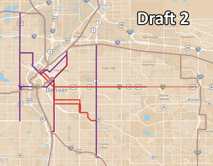
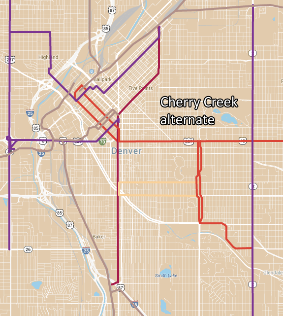
Since I haven't posted the complete map w/ the Decatur/Auraria bus connection, here it is:
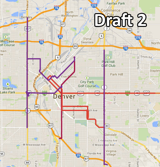
The big questions right now are: - What's the best way to serve Auraria? Bus line or reroute the Colfax streetcar, or something else?
- Do we need a Highlands line, and if so is this the correct one?
|
I like much of your workup. However, I do have a few caveats.
IMO, the Colorado Blvd and Colfax Lines are the keys to your scheme, and, there in lie the fundamental problems with your design.
You have two design pieces- one that lies within a 3 or 4 mile radius of the DUS Civic Station spine, and, the other outside of this. The inner grouping consists of three well thought out loops- the Federal/near 20th/Colfax loop, the Broadway, 6th Avenue, Colorado Blvd loop, and the Downing, Walnut/Blake, 17th Street loops, and, one that is less practical- let's call that the Denver Country Club loop.
Loops are excellent when the relationship between average speed traveling the loop (or the sum of time traveling each leg of the loop) and the distance of the loop, is below a certain value. In addition, loops work best when they bypassed the urban center, i.e., the loops connect arms or spokes, which greatly enhances user efficiency. Quite simply, the user can travel to a larger part of a local area without switching downtown.
On your design you have two powerful switch points on your loops. These are at DUS and Civic station.
We are, however, looking at all of the city of Denver, and, your design does adequately cover Denver east of Colorado Blvd. For example, someone living any where west of Colorado Blvd, east of Federal, south of I-70, and north of I-25 would have steel rail transportation with 2 to 2.5 miles.
This keys in, too, with time required to travel. For example- the Colfax line (whatever mode) would be very fast, perhaps 10 minutes or less from the Federal Street light rail station to Civic Station. This T line makes a Federal Street car line practical from Alameda north (10 - 15 minutes). This is an excellent loop (including transferring to shuttle or whatever is serving the spine, and would eliminate the W line to Central Spine design flaw.
Loop number 2 is the Civic Station via Broadway to Broadway Station, and, back via Central Corridor light rail loop, with (the likely) split up of north and southbound routing between Broadway and Lincoln.
Loop number 3 is the eventual loop made by returning the Downing extension to DUS via Blake.
Finally there is the Denver Country Club loop. Of all your loops, this serves the least commercial, most high end, residential demographic. This area, while outwardly 'liberal' is intensely protective of any kind of intrusion, and, also is rather low density. I would eliminate the 6th/8th Avenue part of the loop.
I think most of us would agree Colfax and Colorado absolutely need higher speed public transportation. I also suspect that most feel that such a system should pass (or under) near (or through) Civic Center Station further west to the Federal Light Rail Station. Likewise, I believe that the city of Aurora should be invited into extending the system to the I-225 station at Colfax.
The Colorado Blvd system would, as you illustrate, extend from the DIA line to the Colorado Station.
The key for your design system to work, of course, is the average speed of the Colorado Blvd and Colfax lines. I would suggest 15 to 20 mph. Herein lies the critical part of your entire design.
More thoughts later.


 Prev
Prev


 )
)

 Linear Mode
