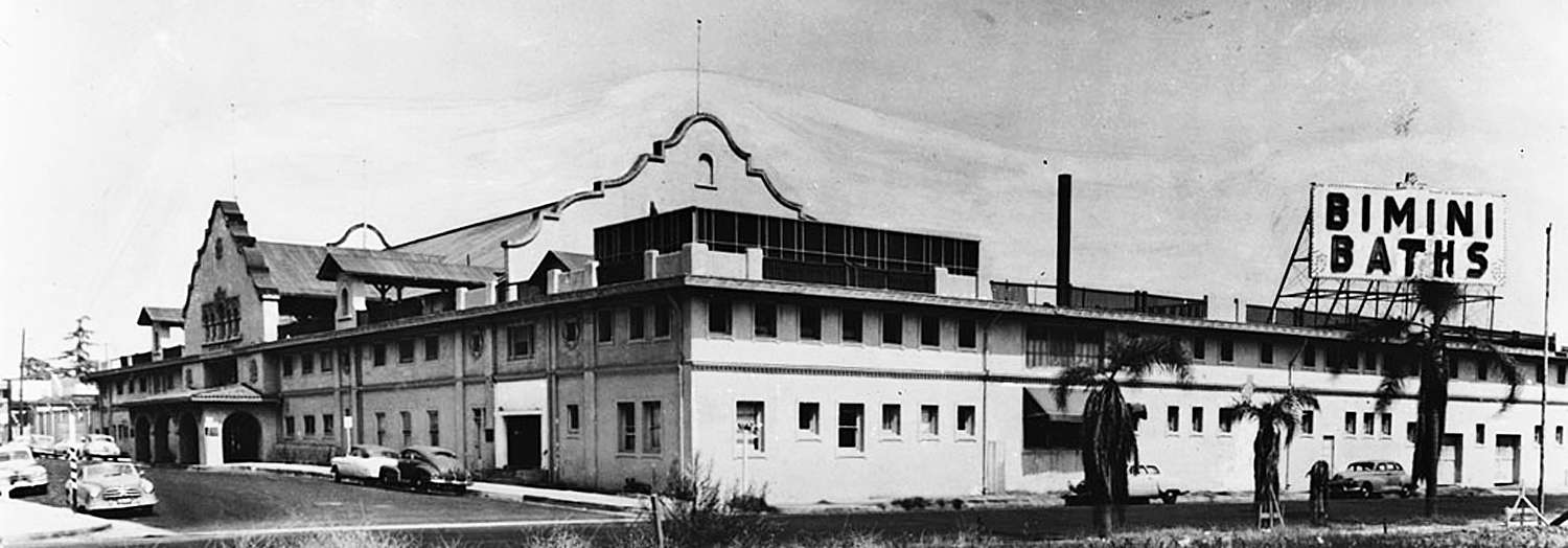
Quote:
Originally Posted by ethereal_reality

|
Quote:
Originally Posted by HossC
|
After reading
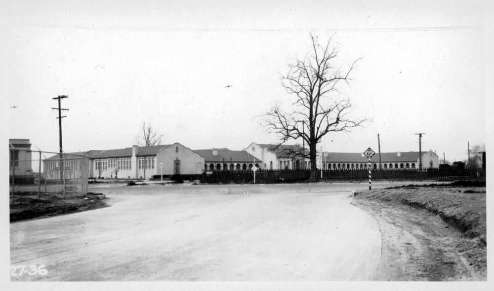
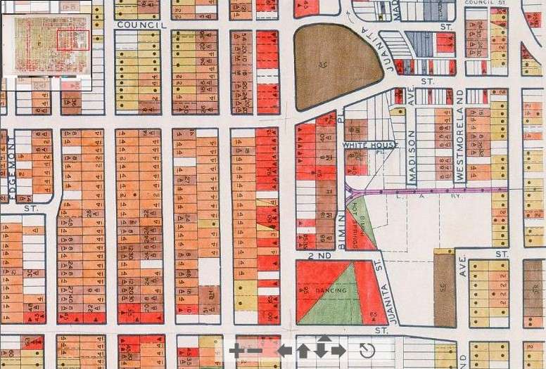
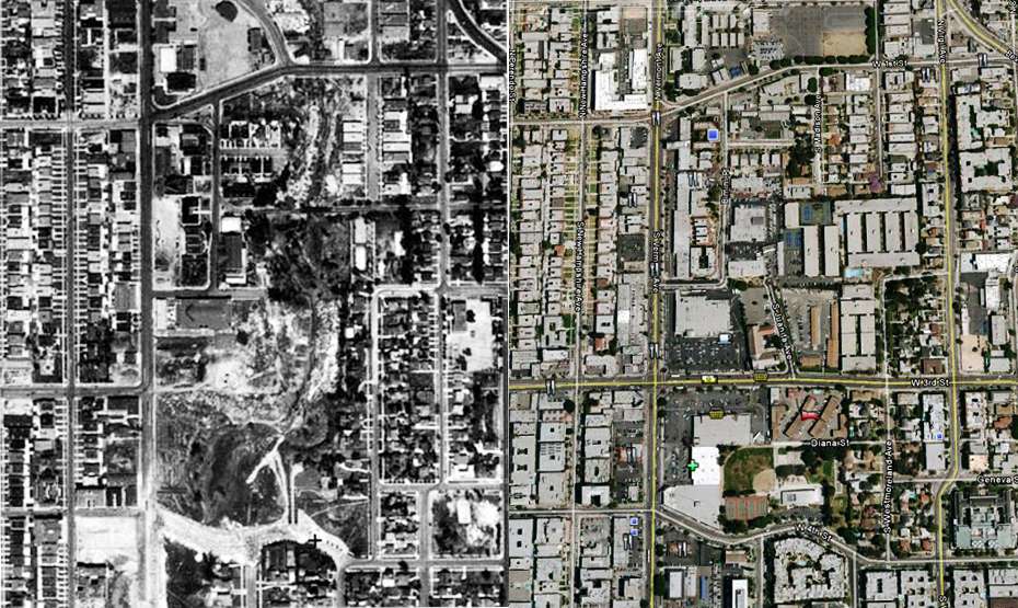
ProphetM's suppositions about the location of the El Monte photograph, I looked up the area on Historic Aerials. The Historic Aerials image dates from 1948, about 20 years after the photos, but before the roads changed to their current layout.
I've marked the church from the original photo in blue, with the blue arrow denoting roughly where I think the photographer was standing. The building outlined in red is the one in the photo that I found in the USC Library. The red arrow marks the photographer's position for that picture. I believe the photographs show two sides of the same tree, with the corner of the church just visible on the left of the second picture. The second aerial shows how the intersection looks today.
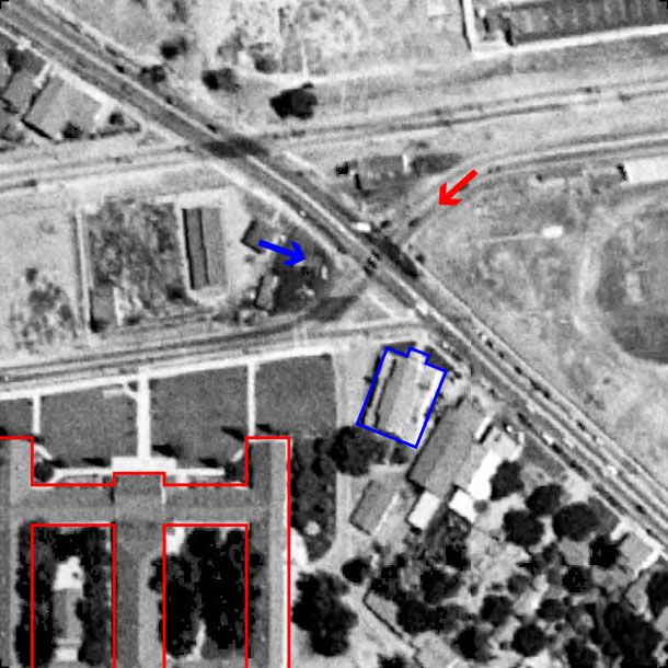
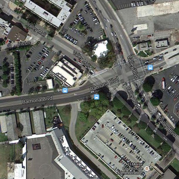
Historic Aerials/Google Maps
The structure outlined in red had already gone when the 1954 aerial was taken. The building which replaced it is the Columbia School, which ties in with
ProphetM's suggestion that Ramona Boulevard used to be Columbia Street. The church was still there in 1954, but gone by 1972.


 Prev
Prev


 Linear Mode
