I woke up on Day 3 in another state. My friend and I stayed as the SLS. It was previously the Sahara, one of the last Old Vegas casinos on the Strip. The hotel builings are still the same. Interestingly enough, every time I've stayed in Las Vegas, I stayed in the Sahara buildings. The first two times were in 2004 and 2005. I knew the Sahara was gone this time around, and my friend said that we were going to a place a few steps up from the Sahara. I laughed when we had pulled up the night before and saw we were staying where I had stayed before. My friend learned that fancy interiors, trendy names, and smooth rebranding can make an old building new again.
Las Vegas has always seemed like the most "open" city that I've ever been to. It's hard to explain. By open, I mean that you just see out for miles and miles into the desert (from your hotel room), and into the wild. I experienced it the first two times I was in Las Vegas, but those were my first two times out west, with my third time ever being in 2009 to San Diego, so I had nothing to gauge what I was feeling. Having been in San Diego, San Francisco, and especially Phoenix now, I had something to compare Las Vegas to. Las Vegas still felt the same way when I woke up. Waking up with a view that stretches uninterrupted for miles until the mountains is still abnormally open to me. It's like Las Vegas is at the bottom of a huge earthly bowl, or something. Then, when viewing it from a hotel room on a clear, warm morning, it's like you're looking out onto the entire world. I've been high up on the East Coast before: the Empire State Building, the CN Tower, Lookout Mountain in Chattanooga, etc, and when high up in these places, you have hundreds of things to look out at: looking for other states, looking for skylines of other cities, water features, hills and mountains, and so on. These features make the distances that you're seeing seem smaller, or put things in perspective. In Las Vegas, there's almost nothing to look out at. It's flat, there's only one city in the valley, and there are relatively few buildings above the tree line to see, much less want to look for. So, you just end up looking straight out at the mountains miles and miles away.
As I did in 2004 and 2005, I took some pictures from out the window of Downtown Las Vegas and elsewhere, looking north and east.
I woke up to this view.
Downtown Las Vegas.
Let's compare it to April, 2005.

Residential areas north of Sahara Avenue in Las Vegas. The Las Vegas city limits are at Sahara Avenue, at the bottom of the picture. I believe that neighborhood is Beverly Green.

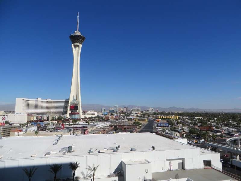
The Stratosphere, on Las Vegas Boulevard north of Sahara Avenue. The original hotel building, at the very right, was built in 1979 as Vegas World. The tower and main hotel building were added in 1996 when Vegas World became the Stratosphere.

Neon signs and roadside architecture line Las Vegas Boulevard north of Sahara Avenue. These signs date back to the 1950s; the Chapel of the Bells opened in 1957, for instance.

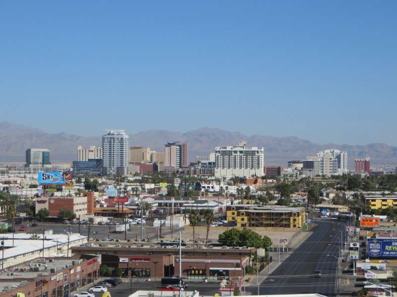
Let's look at Downtown one more time. Have any of you that have ever been to Las Vegas gone Downtown? (I have.) There's a few historic buildings there.
The Stratosphere Tower dominates the Las Vegas skyline. At 1,149 feet tall, it is the tallest freestanding observation tower in the United States, and the second-tallest in North America, after the CN Tower in Toronto. It is also the tallest building in the United States west of the Mississippi River.

Frenchman Mountain is east of Las Vegas, and is 4,056 feet (1,236 m) high, with a topographic prominence of 1,972 feet (601 m). Frenchman Mountain is the first real mountain that I've ever seen. I woke up the morning after arriving in Las Vegas the night of my first trip, and this was standing out at the edge of the metro area from the hotel window.
This was a lot different from the mountains that I had seen in Pennsylvania and New York.

Off in the distance, to the northeast, is Las Vegas Motor Speedway, and part of Nellis Air Force Base. Las Vegas Speedway, about 12 miles away from the SLS, opened in 1996.

Here's a closer look at the Beverly Green neighborhood.
I used the 80x digital zoom on my camera to see what details I could see on the Stratosphere from my room at the SLS.

From the parking lot at SLS, the incomplete Fontainebleau Resort is visible. The Fontainebleau was begun in 2007, and topped out in 2008, before construction halted due to the recession.
Here's a similar view from the parking garage of the then-Sahara in 2005.
Down Las Vegas Boulevard, the Echelon Place casino is another resort that was never completed. This casino was started in 2007, and construction stopped in 2008, amid declining profits from the recession.

An office building sits at Sahara Avenue and Rancho Drive in a largely residential area.

Palace Station, located on Sahara Avenue west of I-15, is on the left here. Palace Station opened in 1976 as The Casino, was renamed the Bingo Palace in 1977, renamed the Palace Station in 1984, and had the tower built in 1990. Palace Station is a locals casino, and has a large Asian customer base due to its baccarat tables and proximity to Chinatown.

The Spring Mountains to the west of the Las Vegas valley provide a great backdrop to the city. La Madre Mountain is the tallest mountain viewable from the valley floor, and is 8,154 feet (2,485 m) high.

We then took a drive down the Strip for a bit.
We first passed the Encore at the Wynn, which was built in 2008 after the Wynn opened in 2005.

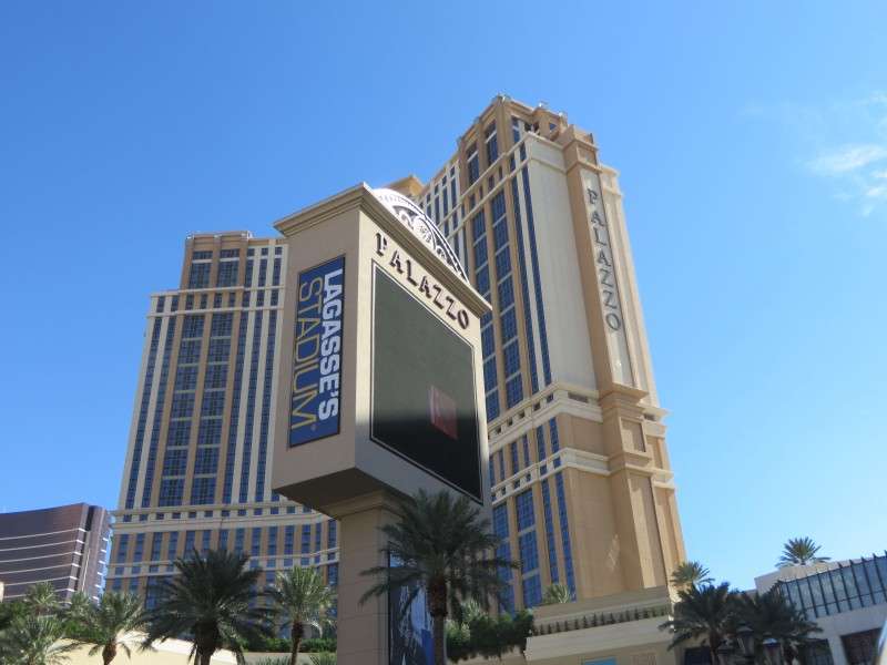
Then we passed the Palazzo, which opened in 2007. At 642 feet (196 m), the Palazzo is tallest completed building in Nevada, and the largest hotel in the world.
One of the older casino buldings is the former Imperial Palace. It opened in 1959 as the Capri Motel, and the tower was built in 1977. Imperial Palace was renamed the Quad in 2012, and was renamed again a few days after this picture as the LINQ. The detailing on the highrise clearly points back to its days as the Imperial Palace, though.

Flamingo is the oldest resort casino operating on the Strip. Opened in 1946, it was run by Bugsy Siegel, who skimmed money from the construction and was eventually killed for it. Highrises were added beginning in 1967, with the current ones built between 1976 and 1993. The famous marquee sign was installed in 1976.

New York New York is located on Las Vegas Boulevard at Tropicana Avenue. The casino was completed in 1997, and features cartoon-like replicas of many famous New York City landmarks in the highrise, facade, and interior. The Empire State Building, Chrysler Building, and Lever House are notable skyscrapers replicated with the casino's highrise.

The Welcome to Fabulous Las Vegas sign is considered the southern end of the Las Vegas Strip. It sits across from the site of the Klondike Casino, and is south of Mandalay Bay. The sign was erected in 1959, and is the only entrance sign on the National Register of Historic Places.

The Little Church of the West is across the street from Manadalay Bay Casino. The church was built in 1942, and is the first known structure in Las Vegas to be built as a wedding chapel. The church was originally located at the Last Frontier Casino.

After a little drive on the Strip, it was time to leave Las Vegas and head to Phoenix. The views of the mountains to the east are great as you drive down Tropicana Avenue.

This mountain, along I-515 in Henderson, is striking to me because it is so bare. Las Vegas is clearly in the drier Mojave Desert.

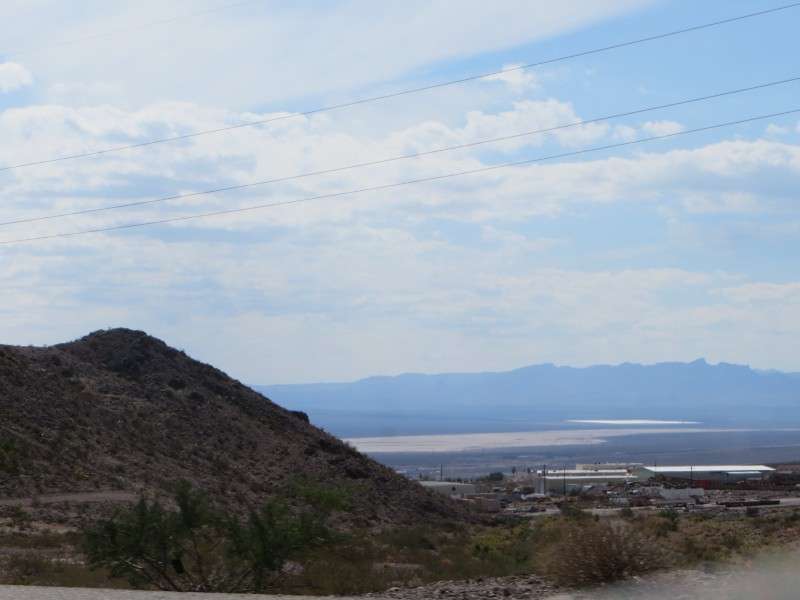
As you round a bend in U.S. Route 93/95 after passing through Henderson, you can see south out into the desert.
You can then see U.S. Route 95, which goes south towards the Laughlin area and then into California at I-40.

You can also see Boulder City Municipal Airport, behind a golf club.

After driving through Boulder City, you begin to see Lake Mead.


In the distance you can see the Hacienda Casino. This is a different casino than the Hacienda that was once located on the Strip in Las Vegas. This casino opened in 1958 as the Gold Strike, and then reopened in 199 as the Hacienda after a fire. It has actually changed its name since my trip in October, to the Hoover Dam Lodge. The casino mainly caters to locals and truckers.

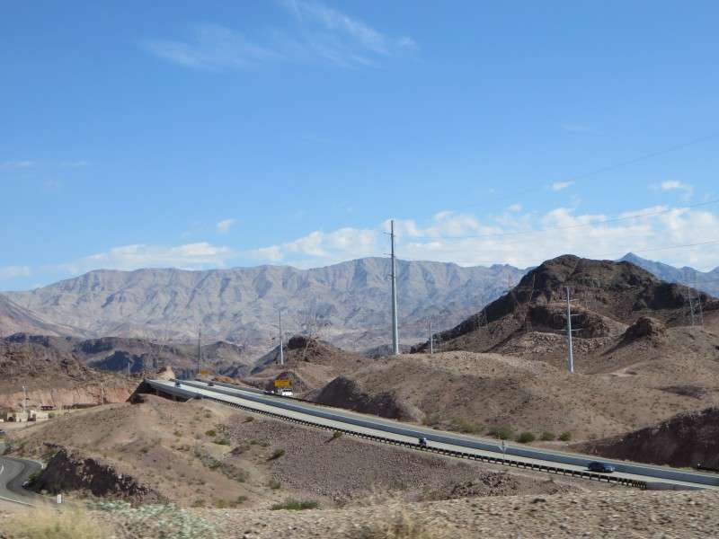
With the future I-11 corridor built over the Colorado River, you now have to exit the expressway in order to see Hoover Dam.
"Winged Figures of the Republic" sits next to the dam on the Nevada side. The sculpture was dedicated in 1935 to those who envisioned the dam bringing prosperity to the desert.

Hoover Dam is huge!
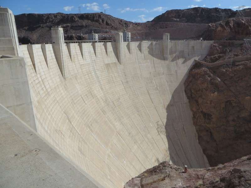
Hoover Dam is 726.4 feet (221.4 m) tall, and has a crest length of 1,244 feet (379 m). It was built between 1931 and 1935.
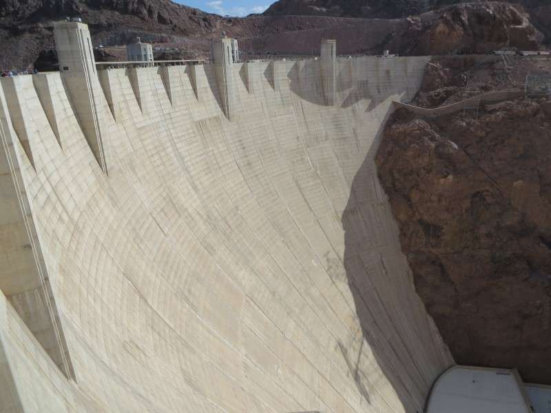
Equally as impressive is Black Canyon. Some would argue that a great natural wonder was lost when Hoover Dam was built.


The U-shaped power plant can be seen if you look down the wall of the dam.

A bathtub ring on Lake Mead shows how high the water level has been, as well as how low the water level is now.

Hoover Dam was originally named Boulder Dam, until being renamed for President Herbert Hoover in 1947.
Four intake towers use gravity to channel water to penstocks, which sets the turbines in motion.
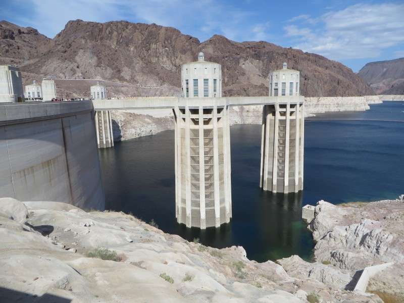
In addition to the bathtub ring, you can see how low the water level has gotten with the dynamited and drilled canyon walls on the side.

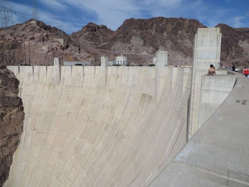
Walking along Hoover Dam takes you into Arizona.

This is the view of Hoover Dam from Arizona.

An exhibit center provides museum space at the dam.

Back on U.S. Route 93, we prepared to cross the new bridge over Black Canyon. Nevada is in the foreground, and Arizona is in the background.

Back into Arizona again!

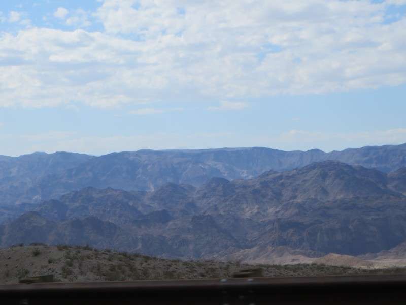
The mountains west of U.S. 93 north of Kingman are the Black Mountains.

We pulled off of U.S. Route 93 to see the ghost town of Chloride. One thing I learned on my trip is that ghost towns have varying definitions. Someone like me, from the East Coast, imagines a town that was completely abandoned, and no one lives there any more (such as Bodie, CA, or Rhyolite, NV). In reality, almost all ghost towns have residents, and the major ghost towns have maintained a base population to some degree.
If you drive through Chloride, you can enter the hills and get a look at the ghost town.

The Cerbat Mountains above Chloride are where the mining was done.

Chloride has a few commercial buildings, although they clearly date back to the town's heyday.
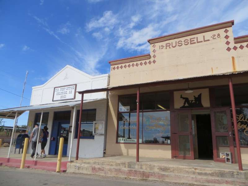
This was Chloride's bank back in the day!

This gas station has some old pumps.

Continuing on, we got onto I-40 in Kingman. Here's a view of the Cerbat Cliffs Golf Course and central Kingman.

East of Kingman, along I-40, you see the desert slowly beginning to change its characteristics.


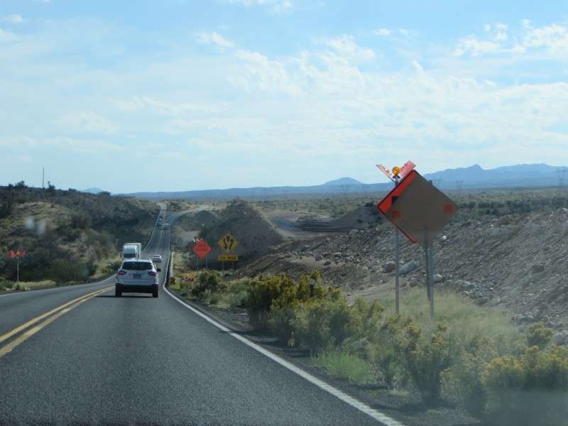
We exited I-40 and continued on U.S. Route 93 towards Phoenix.

Construction of the upgrades for U.S. 93 to turn it into I-11. Even though I mentioned it a few pictures ago, looking back at my pictures this week, it was actually around here when I noticed that the desert was changing, and we were leaving the Mojave Desert and entering the Sonoran Desert. The vegetation increased, and scrubland was in the countryside.
The Aquarius Mountains, to the east of the road, were a sight to see. I actually took a lot of wider pictures of this area to use as the background on my laptop.
I caught a dustdevil in one of those pictures.


There were a few places where the road cut through mountains. It was around here that we drove over Burro Creek Gorge,
which reminded me a little bit of the Zoar Valley/Zoar Creek Gorge in Springville, New York, south of Buffalo, but I did not get a chance to take a picture of Burro Creek.

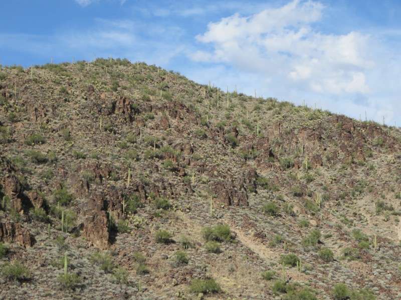
Here's a nice picture of saguaros in their natural habitat, which I was really happy to see in person.
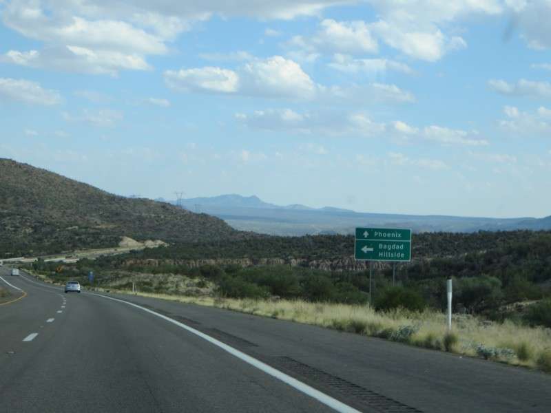
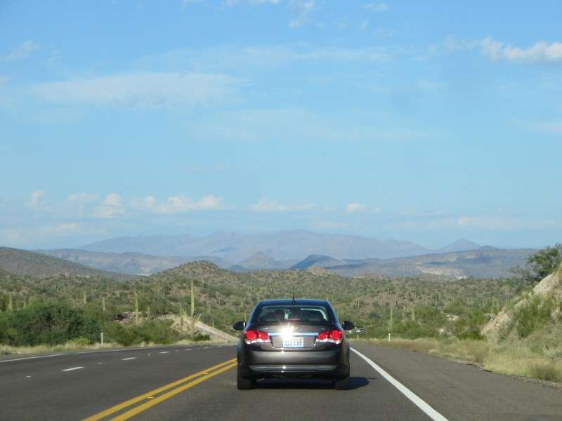
There were some spectacular views of a valley floor east of Arizona Route 97, in western Yavapai County.


As we were driving through the desert with the afternoon sun to our right, we listened to my friend's collection of live U2 music. Between the songs from the Joshua Tree album, inspired by the American West, and the atmospheric sounds of a live stadium concert from that same era, it made for a great soundtrack for the great wide open.

Some more pictures of the desert. Even though some of my pictures didn't turn out too well, it's still interesting to me because deserts are so foreign to my concept of wildlife and vegetation. To see desert plants "in the desert" is an interesting experience.


Joshua Trees are considered part of the Mojave Desert flora, at least according to what I'm finding online, so the brush surrounding the Joshua trees indicates that the lower Sonoran Desert is transitioning with an extension of the higher-elevation Mojave Desert in this part of Yavapai County, way down in central Arizona.
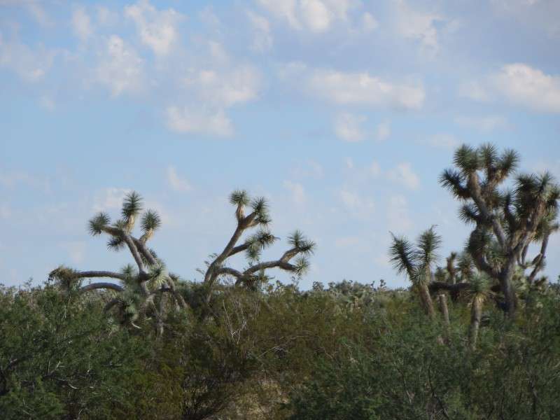
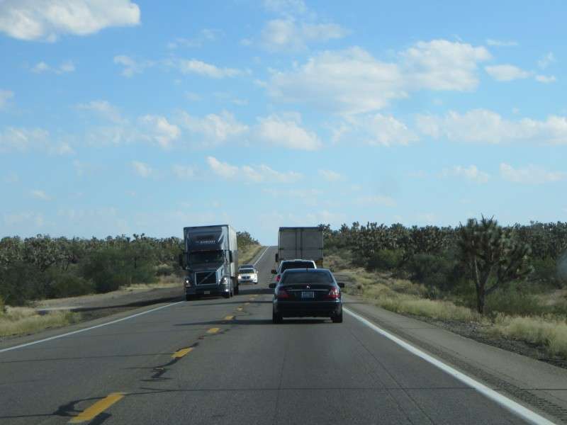
Here's US 93 through the Joshua tree forest. On top of showing what the road and typical traffic are like, this gives a good idea of how tall Joshua trees get.


Approaching Wickenburg, you see a couple signs of human life.

A statue in a traffic circle in Wickenburg showcases the town's rodeo history. The town was gearing up for a rodeo as we drove through. The traffic circle dates back to 2009, when a bypass around the town was completed.

We took Arizona Route 74 to go around the Phoenix metro area and get onto I-17 to get to Scottsdale. The great scenery continued, with saguaros all around. I did not get a chance to take a picture, but you can see University of Phoenix Stadium from the road. The stadium looks like a big spaceship that landed in the valley.
That night, we went into Downtown Scottsdale for an Eagles pep rally, and a party held by the Green Legion, which we tailgate with on these Eagles road trips. The Green Legion had Rockbar, on Craftsman Court, rented out for the night.
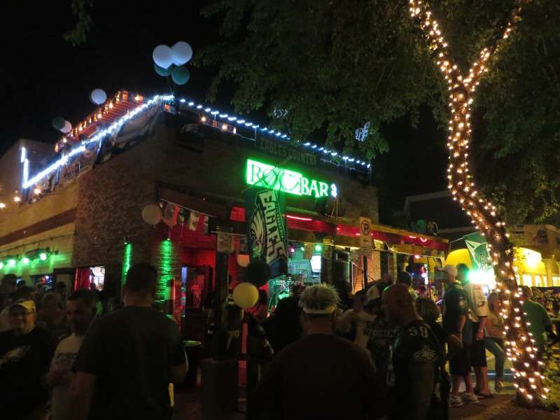
We had Craftsman Court blocked off for drinking in the street, to accommodate the overflow crowd.

 Two more days left! Come back in after I update it again!