Guess something had to make me delurk, and this is it. I've been thinking about this off and on in the past.
Very nice alignment, sperrycgy; more or less what I would suggest. Some random ideas:
I would rename a couple of the stations after the communities rather than the streets, particularly since they would serve multiple streets. Especially McKnight West; we don't need two stations with such similar names -- I'd call it Thorncliffe instead.
Re the Crescent Heights station, I don't think that depth would be a problem here; there are some stations in Portland and DC that are a lot deeper than this would be.
I'm not a geotechnical engineer (and I don't think I know any to ask), so I don't know the cost comparison, but I'd think that a bored tunnel would work a lot better politically; the Canada line cut and cover seems to have raised a lot of stink, from my observations. There are several green spaces along the route that could be used for staging a tunnel boring machine, I think.
I also have a couple of ideas for alternative alignment options.
The one that makes the most sense to me is to bring the tunnel to the surface at 64th Ave; there seems like there could be enough right of way north of there to construct a simpler median line. The 64th Ave station could be a trenched style sort of like the 69th St station, and then rise to the surface north of there. One thing that's nice about this option is that the section south of there could be bored for probably around the same cost as cut and cover all the way to Beddington Trail. So you could leave both as options, and have a NIMBY-off.
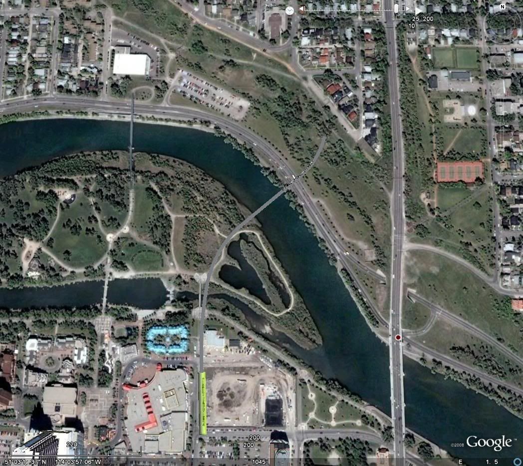
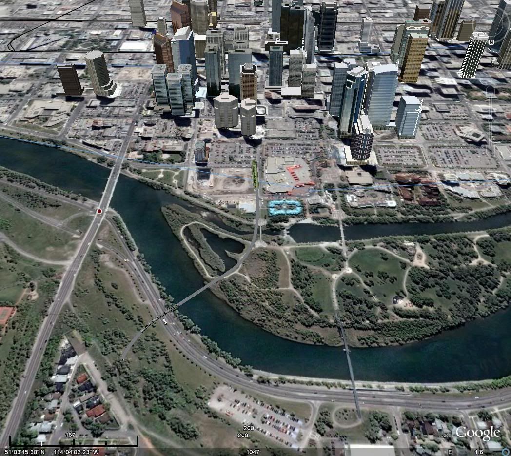
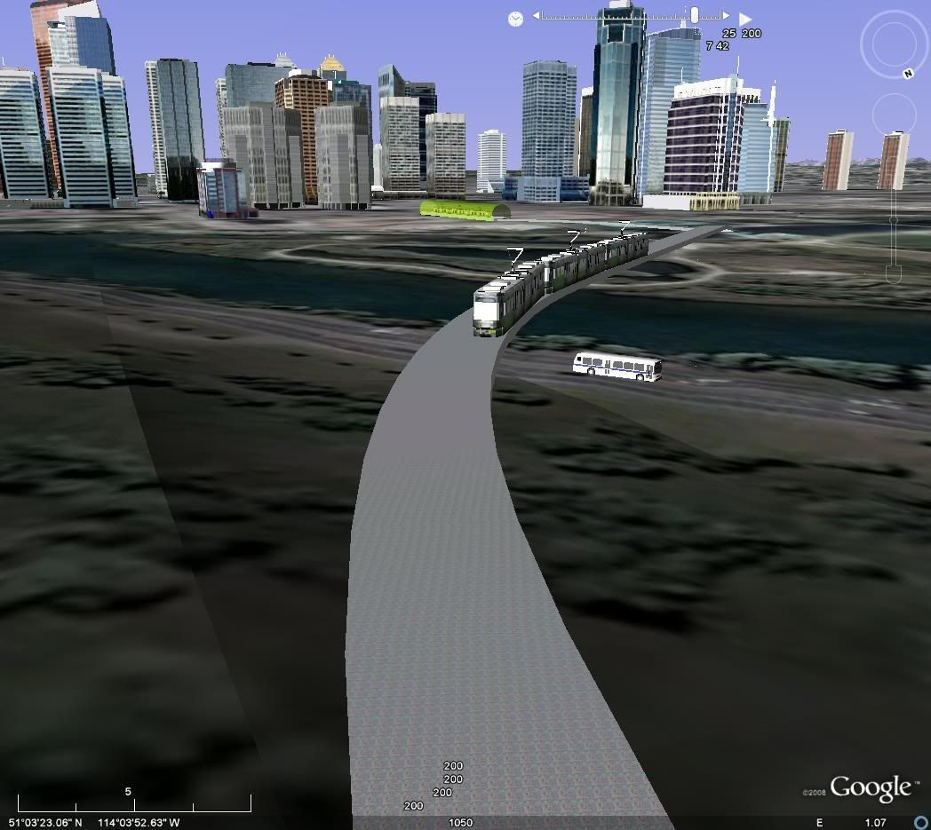
An alternate idea I had at the river would be for the SE line to rise to surface level at Eau Claire, then cross the river on a bridge, going into a tunnel into the side of the hill (McHugh Bluff, right?). It would cross the edge of Prince's Island Park around the boundary between the constructed wetland and the rest of the park, and would probably clear the pathway in a similar fashion to the NW bridge near 10 St. Not ideal, but not unlivable. And I reckon one could build a very nice bridge (i.e. much nicer than the other LRT bridges) for less than a tunnel for the same distance, under the river.
It might look something like this...
Personally, I'm not sure that it's a great time to be doing anything in terms of public pressure, since PlanIt is going to be defending itself from a lot of corners, and this is a long way off from happening. On the other hand, the downtown subway study should include this as an option, and the plan probably should include this as an alternative at least.