Here's a new old Winnipeg street map (1910) that I scanned last night:
link.
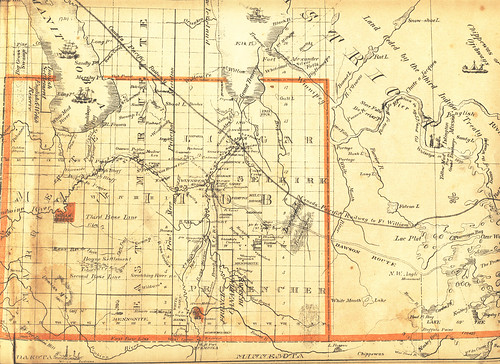
Also, one of my
newest old Manitoba maps, showing the province in its original dimensions in 1876, just six years after it entered Confederation. There are hardly any settlements at this time outside of the longstanding settlements along the rivers, although a few post offices have sprung up and the Mennonite tracts have been designated, along with various other settler areas such as New Iceland and a "Danish Settlement" along the SW shore of Lake Manitoba.